Brénod
| Breno Brénod | |
|---|---|
|
| |
 Grb | |
| Osnovni podaci | |
| Država |  Francuska Francuska |
| Region | Rona-Alpi |
| Departman | Ain |
| Stanovništvo | |
| Stanovništvo (2011-01-01) | 543[1] |
| Gustina stanovništva | 22,82 st./km² |
| Geografija | |
| Koordinate | 46°03′41″N 5°36′22″E / 46.0614°N 5.6061°E / 46.0614; 5.6061 |
| Vremenska zona | UTC+1, ljeti UTC+2 |
| Površina | 23,79 km² |
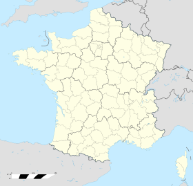
  Breno Breno (Francuske) | |
| Ostali podaci | |
| Poštanski kod | 01110 |
| INSEE kod | 01060 |
Breno (fr. Brénod) je naseljeno mesto u Francuskoj u regionu Rona-Alpi, u departmanu En (Rona-Alpi).
Po podacima iz 1990. godine broj stanovnika u mestu je bio 385, a gustina naseljenosti je iznosila 16 stanovnika/km².
Demografija
| 1962. | 1968. | 1975. | 1982. | 1990. | 2011. |
|---|---|---|---|---|---|
| 509 | 524 | 436 | 431 | 385 | 543 |
Reference
- ↑ „National Institute of Statistics and Economic Studies”.
Literatura
- Alexandra Hughes, Alex Hughes, Keith A Reader, Keith Reader, ur. (2001). Encyclopedia of Contemporary French Culture (Routledge; Routledge World Reference edition izd.). ISBN 0415263549.
- Robb, Graham (2008). The Discovery of France: A Historical Geography. W. W. Norton & Company. ISBN 0393333647.
- Ardagh, John (1991). France (Cultural Atlas of izd.). Facts on File. ISBN 081602619X.
- Jones, Colin (1999). The Cambridge Illustrated History of France (Cambridge Illustrated Histories izd.). Cambridge University Press. ISBN 0521669928.
- Sowerwine, Charles (2009). France since 1870: Culture, Society and the Making of the Republic (2nd izd.). Palgrave Macmillan. ISBN 0230573398.
- Roberts, William J. (2004). France: A Reference Guide from the Renaissance to the Present (European Nations) (European Nations izd.). Facts on File. ISBN 0816044732.
Vidi još
- Departmani Francuske
- Spisak departmana Francuske po gustini naseljenosti
- Spisak departmana Francuske po površini
- Spisak departmana Francuske po broju stanovnika
Vanjske veze

Brénod na Wikimedijinoj ostavi
- Izvor podataka: Insee
- Mape i satelitski snimci:
- Google maps
- MSN-ov atlas sveta Arhivirano 2006-01-26 na Wayback Machine-u
- p
- r
- u
En (Rona-Alpi)
Arbigny • Arbent • Arandas • Aranc • Apremont • Asnières-sur-Saône • Ars-sur-Formans • Attignat • Artemare • Baneins • Balan • Armix • Argis • Abergement-de-Varey • Abergement-Clémenciat • Arbignieu • Beauregard • Beaupont • Anglefort • Andert-et-Condon • Ambérieux-en-Dombes • Ambérieu-en-Bugey • Ambutrix • Ambronay • Ambléon • Boz • Boyeux-Saint-Jérôme • Billiat • Beynost • Bey • Bourg-en-Bresse • Bourg-Saint-Christophe • Bettant • Bouligneux • Champdor • Champagne-en-Valromey • Challex • Challes-la-Montagne • Chaley • Chaleins • Chalamont • Ceyzérieu • Ceyzériat • Cessy • Certines • Cerdon • Béréziat • Béon • Bény • Bénonces • Béligneux • Bâgé-le-Châtel • Bâgé-la-Ville • Buellas • Brénod • Brénaz • Brégnier-Cordon • Belmont-Luthézieu • Bellignat • Belleydoux • Belley • Bellegarde-sur-Valserine • Bolozon • Briord • Brion • Boissey • Boisse • Bohas-Meyriat-Rignat • Blyes • Bressolles • Brens • Biziat • Birieux • Ceignes • Champfromier • Cormoz • Cormoranche-sur-Saône • Cormaranche-en-Bugey • Corlier • Corcelles • Corbonod • Conzieu • Contrevoz • Chevry • Chevroux • Chevillard • Cheignieu-la-Balme • Chazey-sur-Ain • Chazey-Bons • Chavornay • Chaveyriat • Chavannes-sur-Suran • Chavannes-sur-Reyssouze • Charnoz-sur-Ain • Cize • Charix • Civrieux • Chézery-Forens • Chapelle-du-Châtelard • Culoz • Confrançon • Confort • Condeissiat • Condamine • Conand • Cruzilles-lès-Mépillat • Crozet • Crottet • Colomieu • Collonges • Coligny • Cressin-Rochefort • Cras-sur-Reyssouze • Crans • Cleyzieu • Courtes • Courmangoux • Châtillon-sur-Chalaronne • Châtillon-la-Palud • Châtillon-en-Michaille • Châtenay • Chanoz-Châtenay • Chaneins • Chanay • Château-Gaillard • Francheleins • Douvres • Hauteville-Lompnes • Dortan • Hautecourt-Romanèche • Etrez • Domsure • Dompierre-sur-Chalaronne • Giron • Gex • Géovreissiat • Géovreisset • Germagnat • Cuzieu • Curtafond • Curciat-Dongalon • Dagneux • Evosges • Gorrevod • Dompierre-sur-Veyle • Dommartin • Divonne-les-Bains • Frans
| 1962. | 1968. | 1975. | 1982. | 1990. | 2011. |
|---|---|---|---|---|---|
| 509 | 524 | 436 | 431 | 385 | 543 |
 | Ovaj članak o Francuskoj je u začetku. Možete pomoći Wikipediji tako da ga proširite. |


