Coupar Angus
Coupar Angus
| Nom officiel | (en) Coupar Angus  |
|---|---|
| Nom local | (en) Coupar Angus |
| Pays |  Royaume-Uni Royaume-Uni |
|---|---|
| Nation constitutive | Écosse |
| Council area | Perth and Kinross |
| Coordonnées | 56° 32′ 47″ N, 3° 16′ 01″ O |
| Population | 2 350 hab. () |
|---|
| Statut | Small burgh (en) ( - |
|---|

modifier - modifier le code - modifier Wikidata
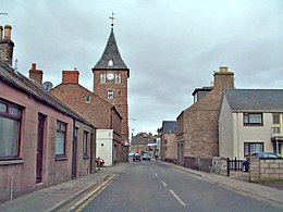
Coupar Angus est un village d'Écosse, sur la rivière Isla affluent du Tay, dans le comté de Perth et Kinross, à 22 kilomètres nord-est de Perth.
On y trouve les restes d'un camp romain et d'une abbaye de Cisterciens fondée en 1163.
 Portail de l’Écosse


