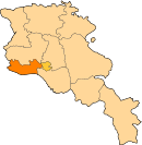
Yeraskhahun
40°04′20″N 44°12′57″E / 40.07222°N 44.21583°E / 40.07222; 44.21583
Place in Armavir, Armenia


Yeraskhahun
Երասխահուն
Երասխահուն
(2011)
Yeraskhahun (Armenian: Երասխահուն, until 1950, Kuru-Araz) is a village in the Armavir Province of Armenia. Half of the population (around 930) of the village are Yazidis.[citation needed]
See also
- Armavir Province
References
- Yeraskhahun at GEOnet Names Server
- World Gazeteer: Armenia[dead link] – World-Gazetteer.com
- Report of the results of the 2001 Armenian Census, Statistical Committee of Armenia
- Kiesling, Brady (2005), Rediscovering Armenia: Guide, Yerevan, Armenia: Matit Graphic Design Studio
- Kiesling, Brady (June 2000). Rediscovering Armenia: An Archaeological/Touristic Gazetteer and Map Set for the Historical Monuments of Armenia (PDF). Archived (PDF) from the original on 6 November 2021.
- v
- t
- e
 Armavir Province
Capital: Armavir
- Armavir
- Metsamor
- Vagharshapat

 | This article about a location in Armavir Province, Armenia is a stub. You can help Wikipedia by expanding it. |
- v
- t
- e


