William G. Milliken State Park and Harbor
State Park in Wayne County, Michigan
42°19′55″N 83°01′42″W / 42.33194°N 83.02833°W / 42.33194; -83.02833[1]
 Michigan portal

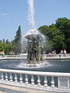
The William G. Milliken State Park and Harbor (formerly named Tri-Centennial State Park and Harbor) is a public recreation area located on the Detroit River just east of downtown Detroit, Michigan, on a portion of the city's International Riverfront. The state park's 31 acres (13 ha) include wetlands, paved trails, and a 52-slip harbor of refuge.[3] A 63-foot (19 m) conical brick lighthouse tower, designed as a scaled-down replica of the Tawas Point Light, marks the harbor entrance.[4]
History
The park consists of the former city-owned St. Aubin Park and Marina and an adjacent reclaimed brownfield. The park area was taken over by the Michigan Department of Natural Resources in 2004 as Tri-Centennial State Park to commemorate the founding of Fort Detroit in 1701. It was Michigan's first state park to be situated in an urban area. Phase I of the park's development, which included refurbishing the marina and construction of the light tower, opened on May 20, 2004. Construction of the 6-acre (2.4 ha) Phase II, or expansion, phase of the project began in summer 2008 and concluded in summer 2009. The Phase II project encompassed a parcel of post-industrial property adjacent to Rivard Plaza.[3] On October 22, 2009, Tri-Centennial State Park was renamed in honor of Governor William G. Milliken.[5] The Lowlands section of the park was officially opened to the public on December 3, 2009.[4]
Ecology
Much of the William G. Milliken State Park has been redeveloped as restoration wetlands, intended to mimic the riverine wetlands that once bordered the Detroit River. The Michigan DNR hopes that these wetlands will be an attractive location for migratory birds. Ninety-seven percent of the former Detroit River wetlands have been lost to development; the de-development of Detroit in the 2000s created an opportunity for wetlands restoration.[5]
Access
The William G. Milliken State Park's official address is 1900 Atwater Street, on the near east side of Detroit and adjacent to the Jefferson Avenue corridor.[5] In 2010, the city completed construction of the "Dequindre Extension" which connects the park to the Dequindre Cut.[6]
Activities and amenities
The park offers shoreline fishing, a picnic area with sail-covered pavilions, and a 52-slip harbor with transient and seasonal tie-ups.[3]
References
- ^ a b "Saint Aubin Marina". Geographic Names Information System. United States Geological Survey, United States Department of the Interior.
- ^ "When were Michigan state parks and recreation areas established?" (PDF). Michigan Department of Natural Resources. Retrieved May 10, 2020.
- ^ a b c "William G. Milliken State Park and Harbor". Michigan Department of Natural Resources. Retrieved December 7, 2009.
- ^ a b "Milliken State Park and Harbor". Detroit RiverFront Conservancy. Retrieved July 16, 2018.
- ^ a b c Michigan Department of Natural Resources (December 3, 2009). "Milliken State Park is officially open" (Press release). Retrieved July 16, 2018.
- ^ "Dequindre Cut". Detroit RiverFront Conservancy. Retrieved July 16, 2018.
External links
Wikimedia Commons has media related to Milliken State Park and Harbor.
- Milliken State Park and Harbor Michigan Department of Natural Resources
- Milliken State Park and Harbor Map Michigan Department of Natural Resources
- v
- t
- e
Parks in metropolitan Detroit
- Belle Isle
- Campau Park
- Campus Martius
- Chandler Park
- Clark Park
- Central Park
- Dequindre Cut
- International Riverfront
- Engel Memorial Park
- Ford Park
- Fort Wayne
- Gabriel Richard Park
- Grand Circus
- Howell Park
- Lafayette Park
- Milliken State Park and Harbor
- New Center Park
- Owen Park
- Palmer Park
- Patton Park
- Reid Memorial Park
- Roosevelt Park
- River Rouge Park
- State Fairgrounds
- Three Mile Drive Park
- UIS Irish Plaza
600 to 1,500 acres (243 to 607 ha)
- Addison Oaks
- Algonac State Park
- Belle Isle
- Camp Dearborn
- Crosswinds Marsh
- Hayes State Park (Irish Hills)
- Independence Oaks
- Lower Huron
- Lakeport State Park
- Maybury State Park
- Metamora-Hadley Recreation Area
- Metro Beach Metropark
- Sterling State Park
- Clinton River
- Detroit River (Islands)
- Huron River
- Lake St. Clair
- River Rouge
- St. Clair River
- Belle Isle
- Kensington
- Lakeside Beach and Park
- Lighthouse Beach and Park
- Metro Beach
- Stony Creek
5 to 36 miles (8 to 58 km)
- Bald Mountain
- Detroit River Walk / Dequindre Cut
- Highland Recreation Lakes
- Kensington
- Lakelands Trail State Park
- Novi North Park
- Paint Creek Trail
- Poly Ann Trail
- Pontiac Lake Recreation Area
- Stony Creek Inwood Trails
- Trails in Detroit
- Waterloo-Pinckney Trail
See also Tourism in metropolitan Detroit and Huron–Clinton Metroparks


