Vida, Montana
Census-designated place in Montana, United States
47°50′1″N 105°29′29″W / 47.83361°N 105.49139°W / 47.83361; -105.49139 (2020)[2]
59274
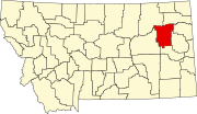
Vida /ˈvaɪdə/ is an unincorporated village and census-designated place (CDP) in northern McCone County, Montana, United States, located on Montana Highway 13 along the Big Sky Back Country Byway,[3][4] approximately 23 miles (37 km) south of Wolf Point, and 30 miles (48 km) north of Circle. As of the 2020 census, the population of Vida was 24.[2]
History
At this location, Vida was known as "Presserville" until 1951,[5] when the post office from a previous incarnation of Vida was moved to that town, and Presserville's citizens agreed to change the town name to conform with the name under which the post office was registered.
Over the intervening decades, the population has dwindled significantly. At the 2000 census,[6] the Vida area had a population of approximately 70 people.[7] The post office remains active, however, along with a "one room schoolhouse" serving northern McCone County and covering grades PK through 8, two churches (one Catholic, one Protestant), two grain elevators, a convenience store, and a gas station.
Vida is part of a census-designated place (CDP) which bears the village's name and which was first listed in 2020.
Demographics
| Census | Pop. | Note | %± |
|---|---|---|---|
| 2020 | 24 | — | |
| U.S. Decennial Census[8] | |||
Climate
According to the Köppen Climate Classification system, Vida has a semi-arid climate, abbreviated "BSk" on climate maps.[9]
References
- ^ "2023 U.S. Gazetteer Files: Montana". United States Census Bureau. Retrieved May 17, 2024.
- ^ a b "P1. Race – Vida CDP, Montana: 2020 DEC Redistricting Data (PL 94-171)". U.S. Census Bureau. Retrieved May 17, 2024.
- ^ "Big Sky Back Country Byway". Federal Highway Administration, United States Department of Transportation. Archived from the original on July 31, 2012. Retrieved January 30, 2007.
- ^ "Big Sky Back Country Byway". Travel Montana, State of Montana. Retrieved January 30, 2007.[permanent dead link]
- ^ "Vida". Montana Place Names Companion. Montana Historical Society. Retrieved April 11, 2021.
- ^ "U.S. Census website". United States Census Bureau. Retrieved January 31, 2008.
- ^ Covers Census Tract 9540, Blocks 3018, 3025, 3026, and 3083-3087. "U.S. Census Table". United States Census Bureau. Retrieved September 15, 2016.
- ^ "Census of Population and Housing". Census.gov. Retrieved June 4, 2016.
- ^ Climate Summary for Vida, Montana
- v
- t
- e
Municipalities and communities of McCone County, Montana, United States
County seat: Circle
‡This populated place also has portions in an adjacent county or counties
- Montana portal
- United States portal
 | This McCone County, Montana state location article is a stub. You can help Wikipedia by expanding it. |
- v
- t
- e


