Ust-Chorna
Urban locality in Zakarpattia Oblast, Ukraine
Urban-type settlement in Zakarpattia Oblast, Ukraine
Ust-Chorna Усть-Чорна | |
|---|---|
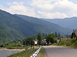 View of the mountains surrounding Ust-Chorna. | |
 Flag | |
48°19′09″N 23°56′20″E / 48.31917°N 23.93889°E / 48.31917; 23.93889 | |
| Country |  Ukraine Ukraine |
| Oblast |  Zakarpattia Oblast Zakarpattia Oblast |
| Raion | Tiachiv Raion |
| Established | 1760s |
| Town status | 1957 |
| Elevation | 536 m (1,759 ft) |
| Population (2022) | |
| • Total |  1,547 1,547 |
| Time zone | UTC+2 (EET) |
| • Summer (DST) | UTC+3 (EEST) |
| Postal code | 90520 |
| Area code | +380 3134 |
| Website | rada |
 | |
Ust-Chorna (Ukrainian: Усть-Чорна; German: Königsfeld; Hungarian: Királymező; Slovak: Usť-Čorna or historically Kraľovo Pole) is an urban-type settlement in Tiachiv Raion, Zakarpattia Oblast, western Ukraine.[2] The settlement's population was 1,456 as of the 2001 Ukrainian Census.[2] Current population: 1,547 (2022 estimate).[3]
Demographics
Native language according to the 2001 Ukrainian census:[4]
References
Wikimedia Commons has media related to Ust-Chorna.
- ^ "Ust-Chorna (Zakarpattia Oblast, Tiachiv Raion)". weather.in.ua. Retrieved 25 December 2012.
- ^ a b "Ust-Chorna, Zakarpattia Oblast, Tiachiv Raion". Regions of Ukraine and their Structure (in Ukrainian). Verkhovna Rada of Ukraine. Retrieved 25 December 2012.
- ^ Чисельність наявного населення України на 1 січня 2022 [Number of Present Population of Ukraine, as of January 1, 2022] (PDF) (in Ukrainian and English). Kyiv: State Statistics Service of Ukraine. Archived (PDF) from the original on 4 July 2022.
- ^ https://socialdata.org.ua/projects/mova-2001/
- v
- t
- e
- Baranyntsi
- Batiovo
- Bedevlia
- Berehove
- Bilky
- Bohdan
- Bushtyno
- Chop
- Chynadiiovo
- Dovhe
- Drahovo
- Dubove
- Dubrynychi
- Horinchovo
- Horonda
- Irshava
- Ivanivtsi
- Kamianske
- Keretsky
- Kholomok
- Khust
- Kolchyno
- Kolochava
- Korolevo
- Koson
- Kostryna
- Mizhhiria
- Mukachevo
- Nelipyno
- Neresnytsia
- Nyzhni Vorota
- Onokivtsi
- Perechyn
- Poliana
- Pyiterfolvo
- Pylypets
- Rakhiv
- Serednie
- Siurte
- Solotvyno
- Stavne
- Svaliava
- Synevyr
- Teresva
- Tiachiv
- Turi Remety
- Uhlia
- Ust-Chorna
- Uzhhorod
- Velyka Bihan
- Velyka Dobron
- Velyki Berehy
- Velyki Luchky
- Velyki Bereznyi
- Velykyi Bychkiv
- Verkhni Koropets
- Vilkhivtsi
- Volovets
- Vylok
- Vynohradiv
- Vyshkovo
- Yasinia
- Zarichia
- Zhdeniievo
Authority control databases | |
|---|---|
| International |
|
| National |
|
 | This article about a location in Zakarpattia Oblast is a stub. You can help Wikipedia by expanding it. |
- v
- t
- e


