Tecali de Herrera
Municipality and town in Puebla, Mexico
Tecali de Herrera (municipality) | |
|---|---|
Municipality and town | |
 16th century Convent of Tecali de Herrera ruins | |
| Country |  Mexico Mexico |
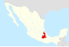
| State | Puebla |
| Time zone | UTC-6 (Central Standard Time) |
| • Summer (DST) | UTC-5 (Central Daylight Time) |

Tecali de Herrera is a town and municipality in the Mexican state of Puebla, southeastern Mexico.[1]
Town
The town of Tecali de Herrera is located about 47 kilometres (29 mi) southeast of the city of Puebla.
It is center of onyx artisan objects production in Mexico.[2] The Municipal Market Onyx is supplied by the local union craftsmen.
History
Pre-Columbian
Tecali was one of the most important cities of the Toltec−Chichimeca nobility, in the pre-Columbian era. It is registered in the "Matricula de Tributos" made during the time of Moctezuma. In the Nahuatl language the name Tecali derives fromtetl (stone) and calli (house), meaning 'where the houses of stone are.' [2]
Convent of Tecali de Herrera
The ruins of the Spanish colonial era Convent of Tecali of Herrera (Ex-Convento de Tecali de Herrera) are a designated Cultural Heritage Monument in the municipality. The former Franciscan convent was completed in 1540, in New Spain (colonial México). It was designed in the Colonial Spanish Renaissance style by Diego de Arciniega.[2]
References
Wikimedia Commons has media related to Tecali de Herrera Municipality.
- ^ "-". Enciclopedia de los Municipios de México. Instituto Nacional para el Federalismo y el Desarrollo Municipal. Retrieved January 4, 2010.
- ^ a b c Midwesternerinmexico.com: "Tecali de Herrera - Mexico’s hub of all things onyx"; posted 29 March 2010; accessed 11.11.2014
External links
- Mid-Westerner in Mexico Blog: Tecali de Herrera — images and text.
- v
- t
- e
 State of Puebla
Puebla (capital)
towns
- Acajete
- Acateno
- Acatzingo
- Acteopan
- Ahuacatlán
- Ahuatlán
- Ahuazotepec
- Ahuehuetitla
- Ajalpan
- Albino Zertuche
- Aljojuca
- Altepexi
- Amixtlán
- Amozoc
- Aquixtla
- Atempan
- Atexcal
- Atlequizayan
- Atlixco
- Atoyatempan
- Atzala
- Atzitzihuacán
- Atzitzintla
- Axutla
- Ayotoxco de Guerrero
- Calpan
- Caltepec
- Camocuautla
- Cañada Morelos
- Caxhuacan
- Coatepec
- Coatzingo
- Cohetzala
- Cohuecán
- Coronango
- Coxcatlán
- Coyomeapan
- Coyotepec
- Cuapiaxtla de Madero
- Cuautempan
- Cuautinchán
- Cuautlancingo
- Cuayuca de Andrade
- Cuetzalan del Progreso
- Cuyoaco
- Chalchicomula de Sesma
- Chapulco
- Chiautla de Tapia
- Chiautzingo
- Chiconcuautla
- Chichiquila
- Chietla
- Chigmecatitlán
- Chignahuapan
- Chignautla
- Chila
- Chila de la Sal
- Chilchotla
- Chinantla
- Domingo Arenas
- Eloxochitlán
- Epatlán
- Esperanza
- Francisco Z. Mena
- General Felipe Angeles
- Guadalupe
- Guadalupe Victoria
- Hermenegildo Galeana
- Honey
- Huaquechula
- Huatlatlauca
- Huauchinango
- Huehuetla
- Huehuetlán el Chico
- Huehuetlán el Grande
- Huejotzingo
- Hueyapan
- Hueytamalco
- Hueytlalpan
- Huitzilan de Serdán
- Huitziltepec
- Ixcamilpa de Guerrero
- Ixcaquixtla
- Ixtacamaxtitlán
- Ixtepec
- Izúcar de Matamoros
- Jalpan
- Jolalpan
- Jonotla
- Jopala
- Juan C. Bonilla
- Juan Galindo
- Juan N. Méndez
- Lafragua
- Libres
- Magdalena Tlatlauquitepec, La
- Mazapiltepec de Juárez
- Mixtla
- Molcaxac
- Naupan
- Nauzontla
- Nealtican
- Nicolás Bravo
- Nopalucan
- Ocotepec
- Ocoyucan
- Olintla
- Oriental
- Pahuatlán
- Palmar de Bravo
- Pantepec
- Petlalcingo
- Piaxtla
- Puebla
- Quecholac
- Quimixtlán
- Rafael Lara Grajales
- Reyes de Juárez, Los
- San Andrés Cholula
- San Antonio Cañada
- San Diego la Meza Tochimiltzingo
- San Felipe Teotlalcingo
- San Felipe Tepatlán
- San Gabriel Chilac
- San Gregorio Atzompa
- San Jerónimo Tecuanipan
- San Jerónimo Xayacatlán
- San José Chiapa
- San José Miahuatlán
- San Juan Atenco
- San Juan Atzompa
- San Juan Raboso
- San Martín Texmelucan
- San Martín Totoltepec
- San Matías Tlalancaleca
- San Miguel Ixitlán
- San Miguel Xoxtla
- San Nicolás Buenos Aires
- San Nicolás de Los Ranchos
- San Pablo Anicano
- San Pedro Cholula
- San Pedro Yeloixtlahuaca
- San Salvador el Seco
- San Salvador el Verde
- San Salvador Huixcolotla
- San Sebastián Tlacotepec
- Santa Catarina Tlaltempan
- Santa Inés Ahuatempan
- Santa Isabel Cholula
- Santiago Miahuatlán
- Santo Tomás Hueyotlipan
- Soltepec
- Tecali de Herrera
- Tecamachalco
- Tecomatlán
- Tehuacán
- Tehuitzingo
- Tenampulco
- Teopantlán
- Teotlalco
- Tepanco de López
- Tepango de Rodríguez
- Tepatlaxco de Hidalgo
- Tepeaca
- Tepemaxalco
- Tepeojuma
- Tepetzintla
- Tepexco
- Tepexi de Rodríguez
- Tepeyahualco
- Tepeyahualco de Cuauhtémoc
- Tetela de Ocampo
- Teteles de Ávila Castillo
- Teziutlán
- Tianguismanalco
- Tilapa
- Tlacotepec de Benito Juárez
- Tlacuilotepec
- Tlachichuca
- Tlahuapan
- Tlaltenango
- Tlanepantla
- Tlaola
- Tlapacoya
- Tlapanalá
- Tlatlauquitepec
- Tlaxco
- Tochimilco
- Tochtepec
- Totoltepec de Guerrero
- Tulcingo
- Tuzamapan de Galeana
- Tzicatlacoyan
- Venustiano Carranza
- Vicente Guerrero
- Xayacatlán de Bravo
- Xicotepec
- Xicotlán
- Xiutetelco
- Xochiapulco
- Xochiltepec
- Xochitlán de Vicente Suárez
- Xochitlán Todos Santos
- Yaonáhuac
- Yehualtepec
- Zacapala
- Zacapoaxtla
- Zacatlán
- Zapotitlán
- Zapotitlán de Méndez
- Zaragoza
- Zautla
- Zihuateutla
- Zinacatepec
- Zongozotla
- Zoquiapan
- Zoquitlán
Authority control databases | |
|---|---|
| International |
|
| National |
|
| Other |
|
18°54′N 97°58′W / 18.900°N 97.967°W / 18.900; -97.967


