Smoleva
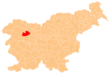
Place in Upper Carniola, Slovenia
46°12′39.99″N 14°9′57.19″E / 46.2111083°N 14.1658861°E / 46.2111083; 14.1658861 Slovenia
 (2002)
Smoleva (pronounced [smɔˈleːʋa]) is a village in the Municipality of Železniki in the Upper Carniola region of Slovenia. It lies in the valley of Lower Smoleva Creek (Slovene: Prednja Smoleva) between Špik Hill (882 meters or 2,894 feet) to the northeast and Mount Vancovec (1,085 meters or 3,560 feet) to the southwest.
References
- ^ Statistical Office of the Republic of Slovenia
External links
 Media related to Smoleva at Wikimedia Commons
- Smoleva on Geopedia
- v
- t
- e
Administrative seat: Železniki
| Current |
|
|---|---|
| Former |
- Dražgoše War Memorial
- Železniki Museum


