Sayler Park, Cincinnati
Neighborhood of Cincinnati in Hamilton, Ohio, United States

Flag
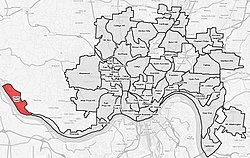
Sayler Park(red) within Cincinnati, Ohio
(2020)
Sayler Park is one of the 52 neighborhoods of Cincinnati, Ohio.[1] Situated along the Ohio River, it is the westernmost neighborhood in the city. The population was 2,825 at the 2020 census.[2]
History
Sayler Park was originally known as Home City.[3] Sayler Park was annexed by the City of Cincinnati in 1911.[4] The neighborhood was struck by an F5 tornado in 1974 during the Super Outbreak, killing three people and destroying several homes.[5]
Demographics
| Year | Pop. | ±% | |
|---|---|---|---|
| 1900 | 2,000 | — | |
| 1910 | 2,013 | +0.6% | |
| 1920 | 2,075 | +3.1% | |
| 1930 | 2,352 | +13.3% | |
| 1940 | 2,627 | +11.7% | |
| 1950 | 2,990 | +13.8% | |
| 1960 | 3,165 | +5.9% | |
| 1970 | 3,430 | +8.4% | |
| 1980 | 3,384 | −1.3% | |
| 1990 | 3,516 | +3.9% | |
| 2000 | 3,233 | −8.0% | |
| 2010 | 2,765 | −14.5% | |
| 2020 | 2,825 | +2.2% | |
| |||
| [citation needed] | |||
As of the census of 2020, there were 2,825 people living in the neighborhood. There were 1,312 housing units. The racial makeup of the neighborhood was 86.8% White, 5.6% Black or African American, 0.2% Native American, 0.3% Asian, 0.0% Pacific Islander, 0.7% from some other race, and 6.4% from two or more races. 2.1% of the population were Hispanic or Latino of any race.[2]
There were 1,193 households, out of which 73.0% were families. 24.0% of all households were made up of individuals.[2]
23.6% of the neighborhood's population were under the age of 18, 60.3% were 18 to 64, and 16.1% were 65 years of age or older. 49.4% of the population were male and 50.6% were female.[2]
According to the U.S. Census American Community Survey, for the period 2016-2020 the estimated median annual income for a household in the neighborhood was $56,918. About 14.7% of family households were living below the poverty line. About 23.8% of adults had a bachelor's degree or higher.[2]
Parks

The 65-acre (26 ha) Fernbank Park in Sayler Park stretches over a mile along the Ohio River.[6] The Thornton Triangle is Cincinnati's smallest municipal park.[7]
References
- ^ U.S. Geological Survey Geographic Names Information System: Sayler Park
- ^ a b c d e "Sayler Park 2020 Statistical Neighborhood Approximation" (PDF). City of Cincinnati. Retrieved 30 December 2023.
- ^ Hand, Greg (November 20, 2017). "From Bucktown To Vanceville: Cincinnati's Lost 19th Century Neighborhoods". Cincinnati. Retrieved July 8, 2019.
- ^ Clarke, S. J. (1912). Cincinnati, the Queen City, 1788-1912, Volume 2. The S. J. Clarke Publishing Company. p. 528. Retrieved 2013-05-20.
- ^ Horstmeyer, Steve (Dec 1995). "It's Not the Heat, It's The..." Cincinnati Magazine. p. 66. Retrieved 2013-05-18.
- ^ "Fernbank Park". Cincinnati Park Board. Retrieved 2013-12-26.
- ^ "Cinciparks". cincinnatiparks.com. Retrieved 2014-06-08.
External links
- Sayler Park Community Council
- v
- t
- e
 City of Cincinnati
- Avondale
- The Banks
- Bond Hill
- California
- Camp Washington
- Carthage
- Clifton
- College Hill
- Columbia-Tusculum
- Corryville
- CUF
- Downtown
- East End
- East Price Hill
- East Walnut Hills
- East Westwood
- English Woods
- Evanston
- Hartwell
- The Heights
- Hyde Park
- Kennedy Heights
- Linwood
- Lower Price Hill
- Madisonville
- Millvale
- Mount Adams
- Mount Airy
- Mount Auburn
- Mount Lookout
- Mount Washington
- North Avondale
- North Fairmount
- Northside
- Oakley
- Over-the-Rhine
- Paddock Hills
- Pendleton
- Pleasant Ridge
- Queensgate
- Riverside
- Roselawn
- Sayler Park
- Sedamsville
- South Cumminsville
- South Fairmount
- Spring Grove Village
- The Villages of Roll Hill
- Walnut Hills
- West End
- West Price Hill
- Westwood
- Winton Hills

| Historic places | |||||||
|---|---|---|---|---|---|---|---|
| Riots | |||||||
| American Civil War |
|
| Museums |
|
|---|---|
| Performing arts | |
| Traditions |
| Professional | |
|---|---|
| Golf Tournaments | |
| College | |
| High school | |
| Tournaments | |
| Venues |
| Public school districts |
|
|---|---|
| Universities and colleges | |
| Education centers | |
| Other |
| Historical services |
|---|
| Authority control databases |
|
|---|
39°06′45″N 84°41′21″W / 39.1125°N 84.6891667°W / 39.1125; -84.6891667
 | This Cincinnati-related article is a stub. You can help Wikipedia by expanding it. |
- v
- t
- e


