Pico de Antónia
Mountain in Cape Verde

Pico de Antónia
central Santiago
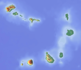
Pico de Antónia is a mountain located in the central part of the island of Santiago in Cape Verde. At 1,392 m (4,567 ft), it is the highest point of the island.[1] The mountain is part of the protected area Parque Natural da Serra do Pico de Antónia.[2][3] The towns Picos and Assomada lie close to the mountain. The Serra do Pico da Antónia has been identified by BirdLife International as an Important Bird Area.[4]
The mountain is at the tripoint of the municipalities of São Salvador do Mundo, São Lourenço dos Órgãos and Ribeira Grande de Santiago. North of the summit is the source of the Ribeira de Pico da Antónia, a source river of the Ribeira Seca.
The Pico da Antónia formation is of volcanic origin, and was formed between 3.3 and 2.3 million years ago during the Piacenzian and the Gelasian periods.[5]
References
- ^ a b Cabo Verde, Statistical Yearbook 2015, Instituto Nacional de Estatística, p. 25
- ^ Resolução nº 36/2016, Estratégia e Plano Nacional de Negócios das Áreas Protegidas
- ^ Decreto-regulamentar n.º 11/2015, 10 December 2015
- ^ "Serra do Pico da Antónia". Important Bird Areas factsheet. BirdLife International. 2013. Retrieved 2013-08-16.
- ^ Holm, P. M. (2008). "An 40Ar-39Ar study of the Cape Verde hot spot: temporal evolution in a semistationary plate environment". Journal of Geophysical Research: Solid Earth. 113. J. Geophys. Res.: B08201. doi:10.1029/2007JB005339.
- v
- t
- e
The island of Santiago
- Pico de Antónia
- Monte Graciosa
- Serra Malagueta
- Monte Tchota
- Monte das Vacas

- Ribeira Grande de Santiago
- Ribeira Principal
- Ribeira Seca
- Ribeira da Trindade
 Category


