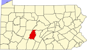
Olivia, Pennsylvania
Census-designated place in Pennsylvania, United States
40°42′44″N 78°12′13″W / 40.71222°N 78.20361°W / 40.71222; -78.20361 (2020)[2]
16686 (Tyrone)
Olivia is an unincorporated community and census-designated place (CDP) in Blair County, Pennsylvania, United States. It was first listed as a CDP prior to the 2020 census.[3]
The CDP is in northern Blair County, in the northeastern part of Snyder Township, along the north side of South Eagle Valley Road (old U.S. Route 220). It is 3.5 miles (5.6 km) northeast of Tyrone and 1.5 miles (2.4 km) southwest of Bald Eagle. The community is on the north side of the valley of Bald Eagle Creek, which flows southwestward to join the Little Juniata River in Tyrone.
Demographics
| Census | Pop. | Note | %± |
|---|---|---|---|
| 2020 | 66 | — | |
| U.S. Decennial Census[4] | |||
References
- ^ "ArcGIS REST Services Directory". United States Census Bureau. Retrieved October 12, 2022.
- ^ "Census Population API". United States Census Bureau. Retrieved October 12, 2022.
- ^ a b "Olivia Census Designated Place". Geographic Names Information System. United States Geological Survey, United States Department of the Interior.
- ^ "Census of Population and Housing". Census.gov. Retrieved June 4, 2016.
- v
- t
- e
Municipalities and communities of Blair County, Pennsylvania, United States
County seat: Hollidaysburg

- Bald Eagle
- Beavertown
- Blue Knob
- Brooks Mill
- Canan Station
- Canoe Creek
- Carson Valley
- Charlottsville
- Clappertown
- Claysburg
- Cotton Town
- Cove Forge
- Cross Keys
- Culp
- Curryville
- Dumb Hundred
- East Altoona
- East Freedom
- East Sharpsburg
- Elberta
- Eldorado
- Fisherville
- Foot of Ten
- Fort Fetter
- Fostoria
- Franklin Forge
- Frankstown
- Fredericksburg
- Friesville
- Ganister
- Geeseytown
- Gray
- Grazierville
- Greenwood
- Henrietta
- Homewood at Martinsburg
- Ironville
- Jugtown
- Juniata Gap
- Klahr
- Lakemont
- Larke
- Leamersville
- Linds Crossing
- Loop
- Martinsburg Junction
- McKee
- Mill Run
- Millerstown
- Moores Mill
- Nealmont
- Newburg
- Northwood
- Olivia
- Ore Hill
- Oreminea
- Penn Farms
- Pinecroft
- Point View
- Puzzletown
- Red Hill
- Reese
- Reightown
- Reservoir
- Robeson Extension
- Roots
- Royer
- Shelltown
- Shellytown
- Sickles Corner
- Skelp
- Ski Gap
- Smith Corner
- Spring Drive Mobile Home Park
- Sproul
- St. Clair
- Sunbrook
- Sylvan Hills
- Tipton
- Tyrone Forge
- Vail
- Vicksburg
- Wopsononock
- Yellow Springs
‡This populated place also has portions in an adjacent county or counties
- Pennsylvania portal
- United States portal
 | This Blair County, Pennsylvania state location article is a stub. You can help Wikipedia by expanding it. |
- v
- t
- e


