National Register of Historic Places listings in Fairfield County, Connecticut

This is intended to be a complete list of the properties and districts on the National Register of Historic Places in Fairfield County, Connecticut, United States. The locations of National Register properties and districts for which the latitude and longitude coordinates are included below may be seen in an online map.[1]
There are 293 properties and districts listed on the National Register in the county, including 9 National Historic Landmarks. Of these, 55 are located in the city of Bridgeport and covered separately in National Register of Historic Places listings in Bridgeport, Connecticut. Thirty-four are covered in National Register of Historic Places listings in Greenwich, Connecticut and another 34 are covered in National Register of Historic Places listings in Stamford, Connecticut. There are 171 properties and districts which are entirely outside those three cities or which span outside, and which are covered here in this list (Merritt Parkway is listed here as well as in the Greenwich and Stamford lists).
All of the National Historic Landmarks are listed here or in the Greenwich and Stamford subareas. Forty-six of these here or in Greenwich or Stamford are historic districts.[2]
Architecture addressed in the NRHP listings is quite varied. Of special interest is an unusual concentration of modern or International Style houses in New Canaan, Connecticut, designed by the "Harvard Five" architects, including: Landis Gores House, the Richard and Geraldine Hodgson House, the Philip Johnson Glass House, and the Noyes House.
There are numerous bridges included in the listings. Seven are moveable bridges, including the Saugatuck River Bridge from 1884, the oldest moveable bridge in the state, and the Washington Bridge which carries U.S. 1 into New Haven County. Five are moveable railway bridges: the Mianus River Railroad Bridge, the Norwalk River Railroad Bridge, the Saugatuck River Railroad Bridge, the Pequonnock River Railroad Bridge (in Bridgeport), and the Housatonic River Railroad Bridge. One bridge is part of a dam and hydroelectric plant complex, the Stevenson Dam Hydroelectric Plant. Five bridges bring roads across shorter crossings: the Perry Avenue Bridge in Norwalk; the Main Street Bridge and the Turn-of-River Bridge in Stamford; the Riverside Avenue Bridge in Greenwich; and the picturesque Pine Creek Park Bridge in Fairfield. Also there are numerous bridges that are included in the Merritt Parkway listing, out of 69 original bridges of the parkway. (This includes both bridges carrying the Merritt Parkway, and bridges crossing it). Other bridges are contributing structures within historic districts, such as the Pulaski Street Bridge within the South End Historic District of Stamford,[3] and a concrete arch bridge from 1941 in the Aspetuck Historic District.[4]: 12
There are nine NRHP-listed lighthouses (including two in Bridgeport).
Seven sites are listed partially or wholly for their association with the marches of French General Rochambeau's troops through the county on their way to and from victory at Yorktown, Virginia, in 1781. The sites still evoke the character of the well-mapped route of the army in 1781 and 1782.
| Fairfield (city of Bridgeport) (town of Greenwich) (city of Stamford) | Hartford (city of Hartford) (town of Southington) (town of West Hartford) (town of Windsor) | Litchfield | Middlesex (city of Middletown) | New Haven (city of New Haven) | New London | Tolland | Windham |
This National Park Service list is complete through NPS recent listings posted June 7, 2024.[5]
Map all coordinates using OpenStreetMap
Download coordinates as:
- KML
- GPX (all coordinates)
- GPX (primary coordinates)
- GPX (secondary coordinates)
Current listings
| [6] | Name on the Register[7] | Image | Date listed[8] | Location | City or town | Description |
|---|---|---|---|---|---|---|
| 1 | The Allen House |  | July 22, 2010 (#10000492) | 4 Burritt's Landing North 41°06′57″N 73°22′32″W / 41.115833°N 73.375556°W / 41.115833; -73.375556 (The Allen House) | Westport | Built in 1958, the house is the only known example in Westport of work by Chicago architect Roy Binkley, Jr.[9] |
| 2 | Aspetuck Historic District |  | August 23, 1991 (#91000437) | Roughly, Redding Rd. from its junction with Old Redding Rd. to Welles Hill Rd. and Old Redding Rd. north past the Aspetuck River 41°13′24″N 73°19′24″W / 41.223333°N 73.323333°W / 41.223333; -73.323333 (Aspetuck Historic District) | Easton and Weston | A historic district that "embodies the distinctive architectural and cultural-landscape characteristics of a farming community from the late colonial and early national periods.... The widely spaced distribution of houses, most accompanied by a barn and all with ample yards that once served as pasture, field or garden recalls the appearance of an inland Connecticut farming community when agriculture was the basis of the local economy."[4] |
| 3 | Caleb Baldwin Tavern |  | August 23, 2002 (#02000869) | 32 Main St. 41°24′46″N 73°18′31″W / 41.412778°N 73.308611°W / 41.412778; -73.308611 (Caleb Baldwin Tavern) | Newtown | Built c. 1763, a two-and-a-half-story house which hosted officers of French commander Rochambeau's troops in 1781 en route to the Siege of Yorktown, Virginia. It also an example of traditional 18th-century New England architecture, and retains some details from that time period. The house is located within the Newtown Borough Historic District.[10] |
| 4 | Ball and Roller Bearing Company |  | August 25, 1989 (#89001087) | 20-22 Maple Ave. 41°23′54″N 73°27′08″W / 41.3983°N 73.4522°W / 41.3983; -73.4522 (Ball and Roller Bearing Company) | Danbury | Also known as American Family Crafts or Joseph McNutt House and Machine Shop, this is a building from 1917, plus a company office building that was the Queen Anne-style former home of Joseph Nutt.[11] |
| 5 | Aaron Barlow House |  | April 29, 1982 (#82004347) | Umpawaug Rd. at Station Rd. 41°19′14″N 73°25′33″W / 41.320556°N 73.425833°W / 41.320556; -73.425833 (Aaron Barlow House) | Redding | Built in 1730; important as a surviving example embodying "the characteristics of early Georgian style domestic architecture that became prominent in the Colonies beginning in the mid-18th century" and also for its association with Col. Aaron Barlow, Joel Barlow, and General Israel Putnam. It is located in the West Redding section of the town.[12] |
| 6 | Daniel and Esther Bartlett House |  | April 15, 1993 (#93000290) | 43 Lonetown Rd. 41°18′40″N 73°23′09″W / 41.311111°N 73.385833°W / 41.311111; -73.385833 (Daniel and Esther Bartlett House) | Redding | Federal style house built in 1796, well-preserved, somewhat unusual for its shingle siding.[13] |
| 7 | Daniel Basset House | 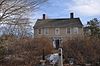 | August 23, 2002 (#02000870) | 1024 Monroe Turnpike 41°20′58″N 73°11′53″W / 41.349444°N 73.198056°W / 41.349444; -73.198056 (Daniel Basset House) | Monroe | Colonial house that was, on June 30, 1781, site of a ball given for a mounted detachment of Rochambeau's army, which camped nearby.[14] |
| 8 | Benedict House and Shop | 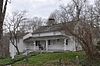 | December 4, 1998 (#98001440) | 57 Rockwell Rd. 41°16′19″N 73°29′32″W / 41.271944°N 73.492222°W / 41.271944; -73.492222 (Benedict House and Shop) | Ridgefield | House was built in 1740 with an adjoining cobbler's shop, significant as a rare surviving example of a colonial artisan's workshop. Sympathetic renovated by architect Cass Gilbert and other care has preserved the property in good condition.[15] |
| 9 | Beth Israel Synagogue |  | November 29, 1991 (#91001684) | 31 Concord St., in South Norwalk 41°05′34″N 73°25′12″W / 41.092778°N 73.42°W / 41.092778; -73.42 (Beth Israel Synagogue) | Norwalk | Former synagogue that is unusual for its Moorish onion domes.[16]: 8–9 |
| 10 | Birdcraft Sanctuary | 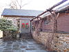 | June 23, 1982 (#82004371) | 314 Unquowa Rd. 41°08′43″N 73°15′31″W / 41.145278°N 73.258611°W / 41.145278; -73.258611 (Birdcraft Sanctuary) | Fairfield | Oldest bird sanctuary in the U.S., where Mabel Osgood Wright originated "birdscaping". |
| 11 | Nathan B. Booth House |  | April 17, 1992 (#92000317) | 6080 Main St. 41°14′21″N 73°06′36″W / 41.239167°N 73.11°W / 41.239167; -73.11 (Nathan B. Booth House) | Stratford | A post-and-beam construction farmhouse built in 1843. It is of vernacular architecture and illustrates a transition between Greek Revival architecture and Federal architecture styles. The house is located in the Putney section of town.[17] |
| 12 | Boothe Homestead |  | May 1, 1985 (#85000951) | Main St. 41°13′34″N 73°06′35″W / 41.226111°N 73.109722°W / 41.226111; -73.109722 (Boothe Homestead) | Stratford | Historic homestead and museum of Americana. |
| 13 | Boston Post Road Historic District |  | December 16, 1982 (#82000997) | 567-728 Boston Post Rd., 1-25 Brookside Rd., and 45-70 Old Kingshighway N. 41°04′51″N 73°27′58″W / 41.080833°N 73.466111°W / 41.080833; -73.466111 (Boston Post Road Historic District) | Darien | Historic district that includes a row of 12 nineteenth-century houses on Boston Post Road, and a town hall and a Greek Revival church.[18] |
| 14 | Bradley Edge Tool Company Historic District |  | November 22, 1995 (#95001347) | Roughly, Lyons Plains Rd. north and south of its junction with White Birch Rd. 41°11′52″N 73°21′13″W / 41.197778°N 73.353611°W / 41.197778; -73.353611 (Bradley Edge Tool Company Historic District) | Weston | District of 30 contributing buildings and the site of the Bradley Edge Tool Company complex, which burned in 1911. Its Miles Bradley House is an "exceptional example of Italianate architecture", with unusual "double bullseye windows".[19] |
| 15 | Bradley-Hubbell House |  | April 18, 2003 (#03000235) | 535 Black Rock Turnpike 41°14′41″N 73°19′15″W / 41.244722°N 73.320833°W / 41.244722; -73.320833 (Bradley-Hubbell House) | Easton | |
| 16 | Bradley-Wheeler House | 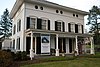 | July 5, 1984 (#84000791) | 25 Avery Pl. 41°08′39″N 73°21′41″W / 41.144167°N 73.361389°W / 41.144167; -73.361389 (Bradley-Wheeler House) | Westport | Headquarters and museum of the Westport Historical Society |
| 17 | Branchville Railroad Tenement |  | August 12, 1982 (#82004346) | Old Main Highway 41°15′56″N 73°26′23″W / 41.265556°N 73.439722°W / 41.265556; -73.439722 (Branchville Railroad Tenement) | Ridgefield | |
| 18 | Marcel Breuer House II |  | September 24, 2010 (#10000572) | 122 Sunset Hill Rd. 41°09′21″N 73°30′25″W / 41.155833°N 73.506944°W / 41.155833; -73.506944 (Marcel Breuer House II) | New Canaan | Mid-Twentieth-Century Modern Residences in Connecticut 1930–1979, MPS |
| 19 | Bridge Street Historic District |  | April 19, 2018 (#100002318) | Bridge St., Imperial Ave. & Compo Rd. S 41°07′23″N 73°21′52″W / 41.122920°N 73.364479°W / 41.122920; -73.364479 (Bridge Street Historic District) | Westport | |
| 20 | Bronson Windmill |  | December 29, 1971 (#71000896) | 3015 Bronson Rd. 41°10′21″N 73°17′32″W / 41.1725°N 73.292222°W / 41.1725; -73.292222 (Bronson Windmill) | Fairfield | |
| 21 | Brookfield Center Historic District |  | August 15, 1991 (#91000992) | Long Meadow Hill Rd. 41°28′04″N 73°23′17″W / 41.467778°N 73.388056°W / 41.467778; -73.388056 (Brookfield Center Historic District) | Brookfield | |
| 22 | Hugh Cain Fulling Mill and Elias Glover Woolen Mill Archeological Site |  | September 19, 1985 (#85002440) | North of Topstone Road on the Norwalk River[20] 41°17′56″N 73°27′21″W / 41.2989°N 73.4559°W / 41.2989; -73.4559 (Hugh Cain Fulling Mill and Elias Glover Woolen Mill Archeological Site) | Ridgefield | |
| 23 | Camps Nos. 10 and 41 of Rochambeau's Army |  | May 6, 2002 (#02000424) | Address Restricted 41°24′53″N 73°18′08″W / 41.414604°N 73.302317°W / 41.414604; -73.302317 (Camps Nos. 10 and 41 of Rochambeau's Army) | Newtown | Marker on US 6 east of Newtown center. |
| 24 | Cannondale Historic District |  | November 12, 1992 (#92001531) | Roughly bounded by Cannon, Danbury and Seeley Rds. 41°13′21″N 73°25′34″W / 41.2225°N 73.426111°W / 41.2225; -73.426111 (Cannondale Historic District) | Wilton | A 202-acre (82 ha) historic district that is significant for coherently embodying "the distinctive architectural and cultural-landscape characteristics of a small commercial center as well as an agricultural community from the early national period through the early 20th century....[including embodying] virtually the full array of human activity in this region—farming, residential, religious, educational, community groups (the Grange), small-scale manufacturing, transportation, and even government (the building that housed the first Cannondale Post Office)."[21] |
| 25 | Arthur and Lyn Chivvis House |  | September 24, 2010 (#10000564) | 2 Wydendown Rd. 41°10′56″N 73°30′27″W / 41.182222°N 73.5075°W / 41.182222; -73.5075 (Arthur and Lyn Chivvis House) | New Canaan | Mid-Twentieth-Century Modern Residences in Connecticut 1930–1979, MPS |
| 26 | Christ Episcopal Church and Tashua Burial Ground |  | April 25, 2001 (#01000401) | 5170 Madison Ave. 41°17′12″N 73°15′38″W / 41.286667°N 73.260556°W / 41.286667; -73.260556 (Christ Episcopal Church and Tashua Burial Ground) | Trumbull | |
| 27 | Commodore Hull School |  | June 30, 1983 (#83001251) | 130 Oak Ave. 41°19′05″N 73°06′03″W / 41.318056°N 73.100833°W / 41.318056; -73.100833 (Commodore Hull School) | Shelton | A former elementary school that was built in 1907, believed to be the only elementary school in Connecticut constructed of terra cotta blocks and reinforced concrete construction, and significant as an example of the movement towards completely fireproof building, in general stirred by the 1871 great fire of Chicago. Its design is "bold, colorful, and striking".[22] |
| 28 | Compo-Owenoke Historic District |  | April 19, 1991 (#91000393) | Roughly bounded by Gray's Creek, Compo Rd. S., and Long Island Sound 41°06′22″N 73°21′18″W / 41.106111°N 73.355°W / 41.106111; -73.355 (Compo-Owenoke Historic District) | Westport | |
| 29 | Abijah Comstock House |  | October 16, 2017 (#100001731) | 1328 Smith Ridge Rd. 41°11′53″N 73°30′29″W / 41.198188°N 73.508152°W / 41.198188; -73.508152 (Abijah Comstock House) | New Canaan | |
| 30 | Cosier-Murphy House |  | July 31, 1991 (#91000994) | 67 CT 39 41°28′11″N 73°28′27″W / 41.469722°N 73.474167°W / 41.469722; -73.474167 (Cosier-Murphy House) | New Fairfield | |
| 31 | Nathaniel Curtis House |  | April 15, 1982 (#82004342) | 600 Housatonic Ave. 41°11′48″N 73°07′12″W / 41.196667°N 73.12°W / 41.196667; -73.12 (Nathaniel Curtis House) | Stratford | |
| 32 | Hanford Davenport House |  | August 3, 1989 (#89000948) | 353 Oenoke Ridge 41°09′35″N 73°30′13″W / 41.159722°N 73.503611°W / 41.159722; -73.503611 (Hanford Davenport House) | New Canaan | |
| 33 | Durisol House |  | September 24, 2010 (#10000566) | 43 Marshall Ridge Rd. 41°08′24″N 73°30′01″W / 41.14°N 73.500278°W / 41.14; -73.500278 (Durisol House) | New Canaan | Mid-Twentieth-Century Modern Residences in Connecticut 1930–1979, MPS |
| 34 | Rev. John Ely House |  | April 25, 2001 (#01000400) | 54 Milwaukee Ave. 41°22′30″N 73°24′13″W / 41.375°N 73.403611°W / 41.375; -73.403611 (Rev. John Ely House) | Bethel | |
| 35 | Fairfield Historic District |  | March 24, 1971 (#71000897) | Old Post Rd. from Post Rd. to Turney Rd. 41°08′38″N 73°14′59″W / 41.143889°N 73.249722°W / 41.143889; -73.249722 (Fairfield Historic District) | Fairfield | |
| 36 | Fairfield Railroad Stations |  | July 28, 1989 (#89000926) | Carter Henry Dr. 41°08′34″N 73°15′29″W / 41.142778°N 73.258056°W / 41.142778; -73.258056 (Fairfield Railroad Stations) | Fairfield | |
| 37 | Five Mile River Landing Historic District |  | September 23, 2009 (#08001189) | Rowayton Ave. to Jo's Barn Way 41°04′13″N 73°26′35″W / 41.070269°N 73.443006°W / 41.070269; -73.443006 (Five Mile River Landing Historic District) | Norwalk | |
| 38 | Elinor and Sherman Ford House |  | September 24, 2010 (#10000574) | 55 Talmadge Hill Rd. 41°06′51″N 73°29′29″W / 41.114167°N 73.491389°W / 41.114167; -73.491389 (Elinor and Sherman Ford House) | New Canaan | Mid-Twentieth-Century Modern Residences in Connecticut 1930–1979, MPS |
| 39 | Gallaher Estate |  | June 23, 2011 (#11000376) | 300 Grumman Ave. 41°09′50″N 73°24′17″W / 41.163889°N 73.404722°W / 41.163889; -73.404722 (Gallaher Estate) | Norwalk | |
| 40 | Georgetown Historic District |  | March 9, 1987 (#87000343) | Roughly bounded by US 7, Portland Ave., CT 107, and the Norwalk River 41°15′19″N 73°25′53″W / 41.255278°N 73.431389°W / 41.255278; -73.431389 (Georgetown Historic District) | Redding and Wilton | Historic district consisting of the former Gilbert and Bennett manufacturing plant, institutional housing built for the plant workers, and other private homes.[23] |
| 41 | Glover House |  | February 11, 1982 (#82004369) | 50 Main St. 41°24′55″N 73°18′36″W / 41.415278°N 73.31°W / 41.415278; -73.31 (Glover House) | Newtown | |
| 42 | John Glover House |  | August 17, 2001 (#01000882) | 53 Echo Valley Rd. 41°26′49″N 73°18′34″W / 41.446944°N 73.309444°W / 41.446944; -73.309444 (John Glover House) | Newtown | |
| 43 | Godillot Place |  | August 29, 1977 (#77001396) | 60, 65 Jesup Rd. 41°08′25″N 73°21′35″W / 41.140278°N 73.359722°W / 41.140278; -73.359722 (Godillot Place) | Westport | A Stick style house built in 1879, an associated cottage, and a carriage barn.[24] |
| 44 | Landis Gores House |  | March 21, 2002 (#02000189) | 192 Cross Ridge Rd. 41°11′54″N 73°29′48″W / 41.198333°N 73.496667°W / 41.198333; -73.496667 (Landis Gores House) | New Canaan | An austere International Style built in 1948, home of Harvard Five architect Landis Gores[25] |
| 45 | Green Farms School |  | April 19, 1991 (#91000391) | Junction of Morningside Dr. S. and Boston Post Rd., In the Greens Farms 41°08′13″N 73°19′31″W / 41.136944°N 73.325278°W / 41.136944; -73.325278 (Green Farms School) | Westport | Tudor Revival style school built in 1925, designed by architect Charles Cutler[26] |
| 46 | Greenfield Hill Grange #133 |  | January 25, 2008 (#07001440) | 1873 Hillside Rd. 41°11′03″N 73°17′38″W / 41.184167°N 73.293889°W / 41.184167; -73.293889 (Greenfield Hill Grange #133) | Fairfield | |
| 47 | Greenfield Hill Historic District |  | March 11, 1971 (#71000899) | Roughly bounded by Meeting House Ln., Hillside Rd., Verna Hil Rd. and Bronson Rd. 41°10′25″N 73°17′28″W / 41.173611°N 73.291111°W / 41.173611; -73.291111 (Greenfield Hill Historic District) | Fairfield | |
| 48 | Greens Ledge Lighthouse |  | May 29, 1990 (#89001468) | Long Island Sound, south of the Five Mile River and west of Norwalk Harbor 41°02′29″N 73°26′40″W / 41.041389°N 73.444444°W / 41.041389; -73.444444 (Greens Ledge Lighthouse) | Norwalk | |
| 49 | Greenwood Avenue Historic District |  | December 17, 1999 (#99001568) | Roughly along Greenwood Ave., P.T. Barnum Sq., Depot Pl., and South St. 41°22′01″N 73°24′48″W / 41.366944°N 73.413333°W / 41.366944; -73.413333 (Greenwood Avenue Historic District) | Bethel | |
| 50 | Isaac Davis and Marion Dalton Hall House |  | September 24, 2010 (#10000573) | 25 Lambert Rd. 41°09′35″N 73°30′10″W / 41.159722°N 73.502778°W / 41.159722; -73.502778 (Isaac Davis and Marion Dalton Hall House) | New Canaan | Mid-Twentieth-Century Modern Residences in Connecticut 1930–1979, MPS |
| 51 | Hampton Inn |  | October 27, 2004 (#89001106) | 179 Oenoke Ridge 41°09′16″N 73°30′00″W / 41.154444°N 73.5°W / 41.154444; -73.5 (Hampton Inn) | New Canaan | |
| 52 | Hattertown Historic District |  | December 6, 1996 (#96001461) | Roughly, junction of Aunt Park Ln., Castle Meadow, Hattertown, and Hi Barlow Rds. 41°20′24″N 73°18′31″W / 41.34°N 73.308611°W / 41.34; -73.308611 (Hattertown Historic District) | Newtown | |
| 53 | Haviland and Elizabeth Streets-Hanford Place Historic District |  | May 26, 1988 (#88000664) | Roughly bounded by Haviland, Day Sts., Hanford Pl., and S. Main St. 41°05′49″N 73°25′07″W / 41.096944°N 73.418611°W / 41.096944; -73.418611 (Haviland and Elizabeth Streets-Hanford Place Historic District) | Norwalk | Cohesive group of 36 late 19th- and early 20th-century houses, exemplifying Queen Anne, Colonial Revival, Italianate, Second Empire architectural styles and vernacular interpretations thereof. The district is located in South Norwalk.[27] |
| 54 | Thomas Hawley House |  | April 11, 1980 (#80004059) | 514 Purdy Hill Rd. 41°18′20″N 73°15′10″W / 41.305556°N 73.252778°W / 41.305556; -73.252778 (Thomas Hawley House) | Monroe | |
| 55 | Hearthstone |  | December 31, 1987 (#87002184) | 18 Brushy Hill Rd. 41°22′41″N 73°26′55″W / 41.37808°N 73.44854°W / 41.37808; -73.44854 (Hearthstone) | Danbury | |
| 56 | Richard and Geraldine Hodgson House |  | January 28, 2005 (#04001549) | 881 Ponus Ridge Rd. 41°08′42″N 73°31′36″W / 41.145°N 73.526667°W / 41.145; -73.526667 (Richard and Geraldine Hodgson House) | New Canaan | |
| 57 | Housatonic River Railroad Bridge |  | June 12, 1987 (#87000842) | Amtrak right-of-way at the Housatonic River 41°12′19″N 73°06′37″W / 41.205278°N 73.110278°W / 41.205278; -73.110278 (Housatonic River Railroad Bridge) | Stratford and Milford | |
| 58 | Hoyt-Burwell-Morse House | 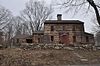 | January 31, 2017 (#100000594) | 8 Ferris Hill Rd., 441 Canoe Hill Rd. 41°10′06″N 73°29′10″W / 41.168279°N 73.486058°W / 41.168279; -73.486058 (Hoyt-Burwell-Morse House) | New Canaan | |
| 59 | Huntington Center Historic District |  | March 31, 2000 (#00000296) | Roughly along Church and Huntington Sts., from Ripton Rd. to the Farmill River 41°17′29″N 73°08′39″W / 41.291389°N 73.144167°W / 41.291389; -73.144167 (Huntington Center Historic District) | Shelton | |
| 60 | Hurlbutt Street School |  | July 25, 1996 (#96000774) | 157 Hurlbutt St. 41°12′03″N 73°24′34″W / 41.2008°N 73.4094°W / 41.2008; -73.4094 (Hurlbutt Street School) | Wilton | |
| 61 | Thomas Hyatt House | 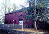 | February 16, 1984 (#84000793) | 11 Barlow Mountain Rd. 41°19′10″N 73°30′41″W / 41.3194°N 73.5114°W / 41.3194; -73.5114 (Thomas Hyatt House) | Ridgefield | |
| 62 | Charles Ives House | 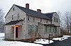 | April 26, 1976 (#76001968) | 7 Mountainville Ave. 41°22′54″N 73°26′43″W / 41.3817°N 73.4453°W / 41.3817; -73.4453 (Charles Ives House) | Danbury | 1780 house of Ives family, moved twice, was birthplace of composer Charles Ives in 1874. |
| 63 | Philip Johnson Glass House |  | February 18, 1997 (#97000341) | 798-856 Ponus Ridge Rd. 41°08′31″N 73°31′47″W / 41.1419°N 73.5297°W / 41.1419; -73.5297 (Philip Johnson Glass House) | New Canaan | Modern masterpiece of glass and steel by architect Philip Johnson. |
| 64 | Capt. David Judson House |  | March 20, 1973 (#73001946) | 967 Academy Hill 41°11′16″N 73°07′47″W / 41.1878°N 73.1297°W / 41.1878; -73.1297 (Capt. David Judson House) | Stratford | Georgian home built in 1723, stone fireplace and foundation from 1639. |
| 65 | Lewis June House |  | February 16, 1984 (#84000795) | 478 N. Salem Rd. 41°19′00″N 73°30′47″W / 41.3167°N 73.5131°W / 41.3167; -73.5131 (Lewis June House) | Ridgefield | |
| 66 | Keeler Tavern |  | April 29, 1982 (#82004345) | 132 Main St. 41°16′22″N 73°29′50″W / 41.2728°N 73.4972°W / 41.2728; -73.4972 (Keeler Tavern) | Ridgefield | |
| 67 | Enos Kellogg House |  | June 27, 2012 (#12000356) | 210 Ponus Ave. Ext. 41°07′56″N 73°27′26″W / 41.1323°N 73.4571°W / 41.1323; -73.4571 (Enos Kellogg House) | Norwalk | |
| 68 | Kettle Creek Historic District | 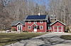 | November 22, 1995 (#95001348) | Roughly, Weston and Old Weston Rds. north of Broad St. 41°11′12″N 73°22′15″W / 41.1867°N 73.3708°W / 41.1867; -73.3708 (Kettle Creek Historic District) | Weston | |
| 69 | Kings Highway North Historic District |  | August 10, 1998 (#98000884) | Roughly along Kings Highway, N., from Wilton Rd. to Woodside Ave. 41°08′26″N 73°22′06″W / 41.1406°N 73.3683°W / 41.1406; -73.3683 (Kings Highway North Historic District) | Westport | |
| 70 | David Lambert House |  | July 24, 1992 (#92000908) | 150 Danbury Rd. 41°10′50″N 73°25′18″W / 41.1806°N 73.4217°W / 41.1806; -73.4217 (David Lambert House) | Wilton | |
| 71 | Nathan B. Lattin Farm | Upload image | May 24, 1990 (#90000760) | 22 Walker Hill Rd. 41°22′11″N 73°12′37″W / 41.3697°N 73.2103°W / 41.3697; -73.2103 (Nathan B. Lattin Farm) | Newtown | |
| 72 | John Black Lee House I |  | September 24, 2010 (#10000568) | 729 Laurel Rd. 41°11′25″N 73°30′01″W / 41.1903°N 73.5003°W / 41.1903; -73.5003 (John Black Lee House I) | New Canaan | Mid-Twentieth-Century Modern Residences in Connecticut 1930–1979, MPS |
| 73 | LeRoy Shirt Company Factory | 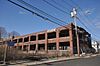 | June 27, 2012 (#12000357) | 11 Chestnut St. 41°05′45″N 73°25′15″W / 41.0957°N 73.4207°W / 41.0957; -73.4207 (LeRoy Shirt Company Factory) | Norwalk | |
| 74 | Isaac Lewis House | 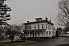 | November 21, 1991 (#91001739) | 50 Paradise Green Pl. 41°12′33″N 73°07′54″W / 41.2092°N 73.1317°W / 41.2092; -73.1317 (Isaac Lewis House) | Stratford | |
| 75 | Lockwood-Mathews Mansion |  | December 30, 1970 (#70000836) | 295 West Ave., in Central Norwalk 41°06′31″N 73°25′05″W / 41.1086°N 73.4181°W / 41.1086; -73.4181 (Lockwood-Mathews Mansion) | Norwalk | Second Empire style mansion built in 1864. |
| 76 | Locust Avenue School |  | May 30, 1985 (#85001162) | 26 Locust Ave. 41°24′18″N 73°26′09″W / 41.405°N 73.4358°W / 41.405; -73.4358 (Locust Avenue School) | Danbury | 1896 school designed by architect Warren Briggs and featured in his Modern American School Buildings. One of the last 19th century schools still used in the state, and one of the last "lab schools", used for advanced teacher training. Today Danbury's alternative high school.[28]: 2, 13 |
| 77 | The Lodges Historic District |  | August 31, 2020 (#100005501) | 68 and 70 South Main St. 41°05′48″N 73°25′08″W / 41.0968°N 73.4189°W / 41.0968; -73.4189 (The Lodges Historic District) | Norwalk | |
| 78 | Joseph Loth Company Building |  | May 17, 1984 (#84000804) | 25 Grand St. 41°07′29″N 73°25′26″W / 41.1247°N 73.4239°W / 41.1247; -73.4239 (Joseph Loth Company Building) | Norwalk | |
| 79 | Phineas Chapman Lounsbury House |  | October 3, 1975 (#75001919) | 316 Main St. 41°16′46″N 73°29′52″W / 41.2794°N 73.4978°W / 41.2794; -73.4978 (Phineas Chapman Lounsbury House) | Ridgefield | |
| 80 | Main Street Historic District |  | November 29, 1983 (#83003508) | Boughton, Elm, Ives, Keeler, Main, West and White Sts. 41°23′39″N 73°27′06″W / 41.3942°N 73.4517°W / 41.3942; -73.4517 (Main Street Historic District) | Danbury | |
| 81 | David Mallett Jr. House |  | February 20, 1986 (#86000266) | 420 Tashua Rd. 41°17′16″N 73°15′37″W / 41.287778°N 73.260278°W / 41.287778; -73.260278 (David Mallett Jr. House) | Trumbull | Built in 1760, an exceptionally well-preserved center-chimney colonial farmhouse, and has significance for its 150 year history of association with the Mallett family. The house is located in the Tashua District of Trumbull.[29] |
| 82 | March Route of Rochambeau's Army: Reservoir Road |  | January 8, 2003 (#02001679) | Junction of Reservoir Rd and Mt. Pleasant Rd. S. 41°24′48″N 73°19′23″W / 41.413333°N 73.323056°W / 41.413333; -73.323056 (March Route of Rochambeau's Army: Reservoir Road) | Newtown | |
| 83 | March Route of Rochambeau's Army: Ridgebury Road |  | June 6, 2003 (#03000313) | Ridgebury Road, from intersection with Old Stagecoach S 41°20′36″N 73°31′47″W / 41.343333°N 73.529722°W / 41.343333; -73.529722 (March Route of Rochambeau's Army: Ridgebury Road) | Ridgefield | |
| 84 | Marvin Tavern |  | April 26, 1984 (#84000806) | 405 Danbury Rd. 41°12′42″N 73°25′58″W / 41.211667°N 73.432778°W / 41.211667; -73.432778 (Marvin Tavern) | Wilton | |
| 85 | Stephen Tyng Mather House |  | October 15, 1966 (#66000877) | 19 Stephen Mather Rd. 41°06′47″N 73°28′31″W / 41.113056°N 73.475278°W / 41.113056; -73.475278 (Stephen Tyng Mather House) | Darien | Home of Stephen Tyng Mather, champion for the formation of the National Park Service and its first director. |
| 86 | Meadowlands |  | October 6, 1987 (#87001408) | 274 Middlesex Rd. 41°04′43″N 73°29′12″W / 41.078611°N 73.486667°W / 41.078611; -73.486667 (Meadowlands) | Darien | |
| 87 | Meeker's Hardware |  | June 9, 1983 (#83001253) | 86-90 White St. 41°23′50″N 73°27′04″W / 41.397222°N 73.451111°W / 41.397222; -73.451111 (Meeker's Hardware) | Danbury | |
| 88 | Merritt Parkway |  | April 17, 1991 (#91000410) | CT 15 and right-of-way between the New York state line and the Housatonic River bridge 41°09′12″N 73°24′14″W / 41.153231°N 73.403953°W / 41.153231; -73.403953 (Merritt Parkway) | Greenwich, Stamford, New Canaan, Norwalk, Westport, Fairfield, Trumbull, Stratford | |
| 89 | Mill Cove Historic District |  | April 19, 1991 (#91000392) | Between Compo Mill Cove and Long Island Sound 41°06′47″N 73°20′32″W / 41.113056°N 73.342222°W / 41.113056; -73.342222 (Mill Cove Historic District) | Westport | |
| 90 | Beaven W. Mills House |  | September 24, 2010 (#10000565) | 31 Chichester Rd. 41°08′52″N 73°31′11″W / 41.147778°N 73.519722°W / 41.147778; -73.519722 (Beaven W. Mills House) | New Canaan | Mid-Twentieth-Century Modern Residences in Connecticut 1930–1979, MPS |
| 91 | Willis N. Mills House |  | September 24, 2010 (#10000567) | 1380 Ponus Ridge Rd. 41°09′31″N 73°32′02″W / 41.158611°N 73.533889°W / 41.158611; -73.533889 (Willis N. Mills House) | New Canaan | Mid-Twentieth-Century Modern Residences in Connecticut 1930–1979, MPS |
| 92 | Monroe Center Historic District |  | August 19, 1977 (#77001392) | CT 110 and CT 111 41°19′57″N 73°12′26″W / 41.3325°N 73.207222°W / 41.3325; -73.207222 (Monroe Center Historic District) | Monroe | |
| 93 | Charles and Peggy Murphy House |  | September 24, 2010 (#10000563) | 320 N Wilton Rd. 41°11′31″N 73°30′02″W / 41.191944°N 73.500556°W / 41.191944; -73.500556 (Charles and Peggy Murphy House) | New Canaan | Mid-Twentieth-Century Modern Residences in Connecticut 1930–1979, MPS |
| 94 | National Hall Historic District |  | September 13, 1984 (#84000812) | Riverside Ave., Wilton and Post Rds.; in downtown Westport, on the west side of (and abutting) the Saugatuck River and north side of Post Road East 41°08′25″N 73°21′54″W / 41.140278°N 73.365°W / 41.140278; -73.365 (National Hall Historic District) | Westport | |
| 95 | New Haven Railroad Danbury Turntable |  | September 15, 2005 (#05001048) | 120 White St. 41°23′49″N 73°26′47″W / 41.396944°N 73.446389°W / 41.396944; -73.446389 (New Haven Railroad Danbury Turntable) | Danbury | A railroad turntable in the yard of the Danbury Railway Museum. |
| 96 | New York Belting and Packing Co. |  | June 2, 1982 (#82004367) | 45-71 and 79-89 Glen Rd. 41°25′52″N 73°16′42″W / 41.431111°N 73.278333°W / 41.431111; -73.278333 (New York Belting and Packing Co.) | Newtown | |
| 97 | Newtown Borough Historic District |  | December 20, 1996 (#96001458) | Roughly, Main St. from Hawley Rd. to Academy Ln. 41°24′43″N 73°18′32″W / 41.411944°N 73.308889°W / 41.411944; -73.308889 (Newtown Borough Historic District) | Newtown | A 100-acre (40 ha)historic district including core of the original borough of Newtown. Includes 225 contributing buildings, a locally important flagpole, and the "Ram's Pasture", a meadow that was common land.[30] |
| 98 | Nichols Farms Historic District |  | August 20, 1987 (#87001392) | Center Rd., 1681-1944 Huntington Turnpike, 5-34 Priscilla Pl., and 30-172 Shelton Rd. 41°14′33″N 73°09′53″W / 41.2425°N 73.164722°W / 41.2425; -73.164722 (Nichols Farms Historic District) | Trumbull | Located atop Mischa Hill along the Farm Highway in Nichols, the district includes many good examples from a wide range of architectural styles from the 17th, 18th, 19th and 20th centuries. The buildings stand together in their original village setting. Most properties include a period barn or carriage house and all have ample yards that once served as pasture, field or garden, and recalls the appearance of an inland Connecticut farming community when agriculture was the basis of the local economy. The architecture also reflects the influences of three stages of economic development, the original agricultural settlement, the 19th century industrial activity, and the 20th century function as a suburb of a large city. |
| 99 | Nichols Satinet Mill Site |  | February 23, 1996 (#96000129) | Address Restricted | Newtown | |
| 100 | Norfield Historic District |  | July 31, 1991 (#91000955) | Roughly, junction of Weston and Norfield Rds. northeast to Hedgerow Common 41°12′04″N 73°22′44″W / 41.201111°N 73.378889°W / 41.201111; -73.378889 (Norfield Historic District) | Weston | |
| 101 | Norwalk City Hall |  | March 23, 1995 (#95000282) | 41 N. Main St., in South Norwalk 41°06′00″N 73°25′08″W / 41.1°N 73.418889°W / 41.1; -73.418889 (Norwalk City Hall) | Norwalk | |
| 102 | Norwalk Green Historic District |  | December 14, 1987 (#87002122) | Roughly bounded by Smith & Park Sts., Boston Post Rd., East, & Morgan Aves. 41°07′07″N 73°24′31″W / 41.118611°N 73.408611°W / 41.118611; -73.408611 (Norwalk Green Historic District) | Norwalk | |
| 103 | Noyes House |  | September 26, 2008 (#08000948) | Country Club Road[31] 41°10′04″N 73°30′15″W / 41.1677°N 73.5041°W / 41.1677; -73.5041 (Noyes House) | New Canaan | International Style house designed by Eliot Noyes. |
| 104 | Norwalk Island Lighthouse |  | January 19, 1989 (#88003222) | Sheffield Island 41°02′55″N 73°25′12″W / 41.048611°N 73.42°W / 41.048611; -73.42 (Norwalk Island Lighthouse) | Norwalk | On Sheffield Island, one of the Norwalk Islands |
| 105 | Norwalk River Railroad Bridge |  | June 12, 1987 (#87000844) | Amtrak/New Haven Line right-of-way at the Norwalk River, in South Norwalk 41°06′02″N 73°24′57″W / 41.100556°N 73.415833°W / 41.100556; -73.415833 (Norwalk River Railroad Bridge) | Norwalk | |
| 106 | Octagon House |  | May 7, 1973 (#73001945) | 21 Spring St. 41°23′42″N 73°27′34″W / 41.395°N 73.459444°W / 41.395; -73.459444 (Octagon House) | Danbury | An octagon house built in 1852 |
| 107 | David Ogden House |  | August 17, 1979 (#79002651) | 1520 Bronson Rd. 41°09′33″N 73°16′37″W / 41.159167°N 73.276944°W / 41.159167; -73.276944 (David Ogden House) | Fairfield | |
| 108 | Old Mine Park Archeological Site |  | December 13, 1990 (#90001807) | Old Mine Park 41°17′17″N 73°13′34″W / 41.288°N 73.226°W / 41.288; -73.226 (Old Mine Park Archeological Site) | Trumbull | |
| 109 | John Osborne House |  | February 12, 1987 (#87000118) | 909 King's Highway, W. 41°08′15″N 73°17′43″W / 41.137411°N 73.295331°W / 41.137411; -73.295331 (John Osborne House) | Fairfield | |
| 110 | Oysterman's Row |  | November 17, 2010 (#10000927) | Roughly bounded by Pond St., Rowayton Ave., Cook St., and Roton Ave. 41°03′47″N 73°26′39″W / 41.063056°N 73.444167°W / 41.063056; -73.444167 (Oysterman's Row) | Norwalk | |
| 111 | Peck Ledge Lighthouse | 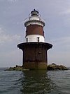 | May 29, 1990 (#89001472) | Long Island Sound, southeast of Norwalk Harbor and northeast of Goose Island 41°04′38″N 73°22′13″W / 41.077222°N 73.370278°W / 41.077222; -73.370278 (Peck Ledge Lighthouse) | Norwalk | |
| 112 | Maxwell E. Perkins House |  | May 6, 2004 (#04000415) | 63 Park St. 41°08′49″N 73°29′45″W / 41.146944°N 73.495833°W / 41.146944; -73.495833 (Maxwell E. Perkins House) | New Canaan | House of Maxwell E. Perkins, the editor of Hemingway, Fitzgerald and Thomas Wolfe. |
| 113 | Perry Avenue Bridge |  | October 25, 2006 (#06000951) | Perry Avenue over Silvermine River 41°09′04″N 73°26′45″W / 41.151111°N 73.445833°W / 41.151111; -73.445833 (Perry Avenue Bridge) | Norwalk | |
| 114 | Pine Creek Park Bridge |  | April 8, 1992 (#92000263) | North of Old Dam Rd., over Pine Creek 41°07′31″N 73°15′48″W / 41.125278°N 73.263333°W / 41.125278; -73.263333 (Pine Creek Park Bridge) | Fairfield | |
| 115 | Plumb Memorial Library |  | November 7, 1978 (#78002845) | 47 Wooster St. 41°19′09″N 73°05′56″W / 41.319167°N 73.098889°W / 41.319167; -73.098889 (Plumb Memorial Library) | Shelton | |
| 116 | Pond-Weed House |  | October 11, 1978 (#78002842) | 2591 Post Rd. 41°03′35″N 73°30′11″W / 41.059722°N 73.503056°W / 41.059722; -73.503056 (Pond-Weed House) | Darien | |
| 117 | Verneur Pratt Historic District |  | July 19, 2011 (#11000434) | 114-116 Perry Avenue[32][33] 41°08′40″N 73°26′10″W / 41.1444°N 73.4362°W / 41.1444; -73.4362 (Verneur Pratt Historic District) | Norwalk | Two adjacent properties associated with inventor Verneur Edmund Pratt, including the Keeler-Pratt House, and an adjacent converted carriage barn used by Pratt as a laboratory. |
| 118 | Putnam Memorial State Park | 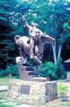 | December 29, 1970 (#70000683) | Junction of Routes 58 (Black Rock Tpke.) and 107 (Park Rd.) 41°20′23″N 73°23′01″W / 41.339722°N 73.383611°W / 41.339722; -73.383611 (Putnam Memorial State Park) | Redding | |
| 119 | Redding Center Historic District |  | October 1, 1992 (#92001253) | Roughly, 4-25B Cross Highway, including Read Cemetery, 61-100 Hill Rd., 0-15 Lonetown Rd. and 118 Sanfordtown Rd. 41°18′14″N 73°22′55″W / 41.303889°N 73.381944°W / 41.303889; -73.381944 (Redding Center Historic District) | Redding | |
| 120 | Frederic Remington House |  | October 15, 1966 (#66000880) | 36 Oak Knoll Road. 41°17′17″N 73°31′01″W / 41.288056°N 73.516944°W / 41.288056; -73.516944 (Frederic Remington House) | Ridgefield | Home of Frederic Remington, a painter and sculptor famous for his depictions of the American West. |
| 121 | Restmore |  | July 1, 2009 (#09000467) | 375 Warner Hill Road 41°09′20″N 73°16′47″W / 41.155556°N 73.279861°W / 41.155556; -73.279861 (Restmore) | Fairfield | |
| 122 | John Rider House |  | November 23, 1977 (#77001388) | 43 Main St. 41°23′18″N 73°26′48″W / 41.388333°N 73.446667°W / 41.388333; -73.446667 (John Rider House) | Danbury | |
| 123 | Ridgebury Congregational Church |  | March 1, 1984 (#84000815) | Ridgebury Rd. and George Washington Highway 41°21′38″N 73°31′32″W / 41.360556°N 73.525556°W / 41.360556; -73.525556 (Ridgebury Congregational Church) | Ridgefield | |
| 124 | Ridgefield Center Historic District | | September 7, 1984 (#84000817) | Roughly bounded by Pound St., Fairview Ave., Prospect, Ridge, and Whipstick Rds. 41°16′35″N 73°29′52″W / 41.276389°N 73.497778°W / 41.276389; -73.497778 (Ridgefield Center Historic District) | Ridgefield | |
| 125 | P. Robinson Fur Cutting Company |  | November 30, 1982 (#82000998) | Oil Mill Rd. 41°23′26″N 73°27′51″W / 41.390556°N 73.464167°W / 41.390556; -73.464167 (P. Robinson Fur Cutting Company) | Danbury | |
| 126 | Rock Ledge |  | August 2, 1977 (#77001394) | South of Norwalk at 33, 40-42 Highland Ave. 41°03′57″N 73°26′11″W / 41.065833°N 73.436389°W / 41.065833; -73.436389 (Rock Ledge) | Norwalk | A mansion that belonged to a U.S. Steel executive. |
| 127 | John Rogers Studio |  | October 15, 1966 (#66000881) | 33 Oenoke Ridge 41°09′01″N 73°29′53″W / 41.150278°N 73.498056°W / 41.150278; -73.498056 (John Rogers Studio) | New Canaan | Studio of nineteenth-century American sculptor John Rogers |
| 128 | Rowayton Depot Historic District | 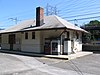 | June 21, 2019 (#15000410) | Rowayton Ave. roughly between Arnold & Witch Lns. 41°04′43″N 73°26′44″W / 41.0785°N 73.4455°W / 41.0785; -73.4455 (Rowayton Depot Historic District) | Norwalk | |
| 129 | St. Mark's Episcopal Church |  | January 25, 2021 (#100006054) | 111 Oenoke Ridge 41°09′09″N 73°29′56″W / 41.1526°N 73.4989°W / 41.1526; -73.4989 (St. Mark's Episcopal Church) | New Canaan | |
| 130 | Sanford-Curtis-Thurber House |  | June 21, 2007 (#07000557) | 71 Riverside Rd. 41°25′31″N 73°15′49″W / 41.425278°N 73.263611°W / 41.425278; -73.263611 (Sanford-Curtis-Thurber House) | Newtown | |
| 131 | Saugatuck River Bridge |  | February 12, 1987 (#87000126) | CT 136 41°07′22″N 73°22′10″W / 41.122778°N 73.369444°W / 41.122778; -73.369444 (Saugatuck River Bridge) | Westport | From 1884, a swinging bridge |
| 132 | Saugatuck River Railroad Bridge |  | June 12, 1987 (#87000846) | Amtrak right-of-way at the Saugatuck River 41°07′10″N 73°22′08″W / 41.119444°N 73.368889°W / 41.119444; -73.368889 (Saugatuck River Railroad Bridge) | Westport | |
| 133 | Seth Seelye House |  | August 29, 1977 (#77001386) | 189 Greenwood Ave. 41°22′16″N 73°24′51″W / 41.371111°N 73.414167°W / 41.371111; -73.414167 (Seth Seelye House) | Bethel | |
| 134 | Shambaugh House |  | April 9, 1999 (#99000432) | 12 Old Hill Rd. 41°08′38″N 73°22′12″W / 41.143889°N 73.37°W / 41.143889; -73.37 (Shambaugh House) | Westport | |
| 135 | Sherman Historic District |  | July 31, 1991 (#91000956) | Roughly the junction of Old Greenswood Rd. and CT 37 Center NE. past the junction of CT 37 E. and CT 39 N., and Sawmill Rd. 41°34′44″N 73°29′51″W / 41.578889°N 73.4975°W / 41.578889; -73.4975 (Sherman Historic District) | Sherman | |
| 136 | Silvermine Center Historic District |  | June 23, 2009 (#07001441) | Roughly centered on Silvermine and Perry Avenues 41°09′03″N 73°26′48″W / 41.150833°N 73.446667°W / 41.150833; -73.446667 (Silvermine Center Historic District) | Norwalk | |
| 137 | Sloan-Raymond-Fitch House |  | April 29, 1982 (#82004344) | 224 Danbury Rd. 41°11′18″N 73°25′32″W / 41.188333°N 73.425556°W / 41.188333; -73.425556 (Sloan-Raymond-Fitch House) | Wilton | |
| 138 | South Main and Washington Streets Historic District | 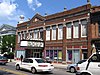 | December 16, 1977 (#77001393) | 68-139 Washington St. and 2-24 S. Main St.; also 11-15 through 54-60 S. Main St.; also roughly along N. Main St. from Washington St. to Ann St. 41°05′55″N 73°24′22″W / 41.098611°N 73.406111°W / 41.098611; -73.406111 (South Main and Washington Streets Historic District) | Norwalk | Second and third sets of boundaries represent boundary increases of November 8, 1985 and April 15, 1999 respectively |
| 139 | Southport Historic District |  | March 24, 1971 (#71000898) | Roughly bounded by Southport Harbor, RR, Old South Rd. and Rose Hill Rd. 41°07′55″N 73°17′04″W / 41.131944°N 73.284444°W / 41.131944; -73.284444 (Southport Historic District) | Fairfield | District of historic, tony homes |
| 140 | Southport Railroad Stations |  | July 28, 1989 (#89000927) | 96 Station St. and 100 Center St. 41°08′11″N 73°17′10″W / 41.136389°N 73.286111°W / 41.136389; -73.286111 (Southport Railroad Stations) | Fairfield | Working railroad station (westbound building) in the Southport section of Fairfield. Repaired in 2009 after a 2008 fire. Eastbound building (pictured) is no longer a working station. |
| 141 | Sterling Homestead |  | January 1, 1976 (#76001973) | 2225 Main St. 41°11′32″N 73°07′51″W / 41.192222°N 73.130833°W / 41.192222; -73.130833 (Sterling Homestead) | Stratford | |
| 142 | Stevenson Dam Hydroelectric Plant |  | September 29, 2000 (#00001073) | CT 34 41°23′03″N 73°10′16″W / 41.384167°N 73.171111°W / 41.384167; -73.171111 (Stevenson Dam Hydroelectric Plant) | Monroe | Dam, bridge, and powerhouse built in 1917 on the Housatonic River.[34] Extends into Oxford in New Haven County. |
| 143 | Stratford Center Historic District | 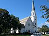 | December 22, 1983 (#83003511) | Roughly bounded by E. Broadway, Ferry Blvd., Housatonic River, Connecticut Tnpke, Birdseye and Main Sts. 41°11′10″N 73°07′49″W / 41.186111°N 73.130278°W / 41.186111; -73.130278 (Stratford Center Historic District) | Stratford | |
| 144 | Stratford Point Lighthouse |  | May 29, 1990 (#89001476) | Stratford Point at mouth of Housatonic River 41°09′07″N 73°06′13″W / 41.151944°N 73.103611°W / 41.151944; -73.103611 (Stratford Point Lighthouse) | Stratford | |
| 145 | Stratford Shoal Lighthouse |  | May 29, 1990 (#89001477) | Middleground Shoal, Long Island Sound 41°03′34″N 73°06′06″W / 41.059444°N 73.101667°W / 41.059444; -73.101667 (Stratford Shoal Lighthouse) | Stratford | Lighthouse on a shoal in the middle of Long Island Sound, sometimes disputed to be located in New York State (in Nassau County, Long Island?), but probably 1,000 feet within Connecticut. |
| 146 | Sturges-Wright House |  | March 31, 2015 (#15000111) | 93 Cross Hwy. 41°09′42″N 73°20′36″W / 41.1618°N 73.3432°W / 41.1618; -73.3432 (Sturges-Wright House) | Westport | |
| 147 | Jonathan Sturges House | 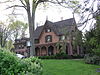 | November 23, 1984 (#84000247) | 449 Mill Plain Rd. 41°08′56″N 73°16′06″W / 41.148889°N 73.268333°W / 41.148889; -73.268333 (Jonathan Sturges House) | Fairfield | 1840 Gothic Revival cottage |
| 148 | James Swallen House |  | September 24, 2010 (#10000570) | 257 Wahackme Rd. 41°08′51″N 73°31′05″W / 41.1475°N 73.518056°W / 41.1475; -73.518056 (James Swallen House) | New Canaan | Mid-Twentieth-Century Modern Residences in Connecticut 1930–1979, MPS |
| 149 | System House |  | September 24, 2010 (#10000571) | 128 Chichester Rd. 41°09′06″N 73°31′14″W / 41.151667°N 73.520556°W / 41.151667; -73.520556 (System House) | New Canaan | Mid-Twentieth-Century Modern Residences in Connecticut 1930–1979, MPS |
| 150 | Ida Tarbell House |  | April 19, 1993 (#93001602) | 320 Valley Rd. 41°18′25″N 73°19′56″W / 41.306944°N 73.332222°W / 41.306944; -73.332222 (Ida Tarbell House) | Easton | Home of the muckraking journalist and author of The History of the Standard Oil Company |
| 151 | Tarrywile |  | January 6, 1988 (#87001409) | Southern Blvd. & Mountain Rd. 41°22′46″N 73°27′10″W / 41.379444°N 73.452778°W / 41.379444; -73.452778 (Tarrywile) | Danbury | A Shingle Style house, with gatehouse, in Danbury, Connecticut that was built in 1895.[35] |
| 152 | Corinne and George Liston Tatum Jr. House |  | September 24, 2010 (#10000569) | 431 Valley Rd. 41°10′17″N 73°28′29″W / 41.171389°N 73.474722°W / 41.171389; -73.474722 (Corinne and George Liston Tatum Jr. House) | New Canaan | Mid-Twentieth-Century Modern Residences in Connecticut 1930–1979, MPS |
| 153 | Titicus Hill Historic District |  | May 17, 2012 (#12000267) | Roughly bounded by junction of Main St. & Danbury Rd., North St. & N. Salem Rd., New St. & N. Salem Rd. 41°17′26″N 73°30′02″W / 41.290585°N 73.500533°W / 41.290585; -73.500533 (Titicus Hill Historic District) | Ridgefield | |
| 154 | Town Hall |  | May 18, 1982 (#82004343) | 90 Post Rd. E. 41°08′28″N 73°21′39″W / 41.141111°N 73.360833°W / 41.141111; -73.360833 (Town Hall) | Westport | The former Town Hall |
| 155 | Umpawaug District School |  | December 1, 1988 (#88002695) | Umpawaug Rd. 41°18′56″N 73°25′46″W / 41.315556°N 73.429444°W / 41.315556; -73.429444 (Umpawaug District School) | Redding | |
| 156 | Union Station |  | September 25, 1986 (#86002750) | White St. and Patriot Dr. 41°23′43″N 73°26′14″W / 41.395278°N 73.437222°W / 41.395278; -73.437222 (Union Station) | Danbury | Next to the Danbury railroad station and close by Meeker's Hardware |
| 157 | US Post Office-South Norwalk Main |  | January 21, 1986 (#86000126) | 16 Washington St. 41°05′56″N 73°25′17″W / 41.098889°N 73.421389°W / 41.098889; -73.421389 (US Post Office-South Norwalk Main) | Norwalk | |
| 158 | United States Post Office, Westport, Connecticut |  | April 3, 2012 (#12000001) | 154 Post Rd. E. 41°08′28″N 73°21′35″W / 41.141233°N 73.359817°W / 41.141233; -73.359817 (United States Post Office, Westport, Connecticut) | Westport | Former post office, now a restaurant |
| 159 | Village Creek |  | July 26, 2010 (#10000493) | Roughly bounded by Village Creek, Hayes Creek and Woodward Ave.[36] 41°04′44″N 73°25′06″W / 41.078889°N 73.418333°W / 41.078889; -73.418333 (Village Creek) | Norwalk | A community in South Norwalk |
| 160 | Wall Street Historic District |  | September 23, 2009 (#09000342) | Roughly bounded by Commerce, Knight, and Wall Sts., West and Mott Aves. 41°07′06″N 73°24′45″W / 41.1182°N 73.4124°W / 41.1182; -73.4124 (Wall Street Historic District) | Norwalk | |
| 161 | Washington Bridge |  | September 29, 2004 (#04001093) | U.S. Route 1 at the Housatonic River 41°12′01″N 73°06′39″W / 41.2003°N 73.1108°W / 41.2003; -73.1108 (Washington Bridge) | Stratford | Extends into Milford in New Haven County. |
| 162 | Waveny |  | September 30, 2019 (#100004543) | Roughly bounded by Lapham, Old Stamford & Farm Rds. and Merritt Pkwy. 41°07′20″N 73°29′27″W / 41.1222°N 73.4908°W / 41.1222; -73.4908 (Waveny) | New Canaan | |
| 163 | David Jr. and Sarah Webb House |  | October 20, 2011 (#11000751) | 1161 Ponus Ridge 41°09′06″N 73°31′48″W / 41.1517°N 73.53°W / 41.1517; -73.53 (David Jr. and Sarah Webb House) | New Canaan | |
| 164 | Weir Farm National Historic Site |  | October 31, 1990 (#03000284) | 735 Nod Hill Road 41°15′21″N 73°27′22″W / 41.2559°N 73.4560°W / 41.2559; -73.4560 (Weir Farm National Historic Site) | Wilton and Ridgefield | |
| 165 | West Mountain Historic District |  | February 23, 1984 (#84000828) | CT 102 41°17′53″N 73°31′44″W / 41.2981°N 73.5289°W / 41.2981; -73.5289 (West Mountain Historic District) | Ridgefield | |
| 166 | Westport Bank and Trust Company |  | November 6, 2006 (#06000593) | 87 Post Rd. E., in downtown Westport 41°08′30″N 73°21′40″W / 41.1417°N 73.3611°W / 41.1417; -73.3611 (Westport Bank and Trust Company) | Westport | |
| 167 | Westport Center Historic District |  | July 19, 2016 (#16000449) | Avery Pl., Bay Elm & Main Sts., Imperial & Myrtle Aves., Church & Violet Lns., Post Rd., E. 41°08′29″N 73°21′40″W / 41.1414°N 73.3612°W / 41.1414; -73.3612 (Westport Center Historic District) | Westport | |
| 168 | Ephraim Wheeler House |  | April 17, 1992 (#92000318) | 470 Whippoorwill Ln. 41°15′11″N 73°06′55″W / 41.2531°N 73.1153°W / 41.2531; -73.1153 (Ephraim Wheeler House) | Stratford | |
| 169 | Whistleville Historic District | Upload image | June 8, 2021 (#100006641) | Ely and Lexington Aves, Hemlock and Lubrano Pls., Knapp, Kossuth, Laura, Olean, Oxford and Snowden Sts. 41°05′24″N 73°25′24″W / 41.0901°N 73.4234°W / 41.0901; -73.4234 (Whistleville Historic District) | Norwalk | |
| 170 | Williams House |  | May 4, 2014 (#13000525) | 5 Williams Rd. 41°27′22″N 73°29′33″W / 41.4562°N 73.4925°W / 41.4562; -73.4925 (Williams House) | New Fairfield | |
| 171 | Wilton Center Historic District |  | August 19, 1992 (#92001003) | Roughly the area around the junction of Lovers Ln. and Belden Hill and Ridgefield Rds. 41°11′43″N 73°26′20″W / 41.1953°N 73.4389°W / 41.1953; -73.4389 (Wilton Center Historic District) | Wilton |
Former listings
| [6] | Name on the Register | Image | Date listed | Date removed | Location | City or town | Description |
|---|---|---|---|---|---|---|---|
| 1 | Kaatz Icehouse |  | September 19, 1977 (#77001395) | October 19, 2009 | North of Trumbull at 255 Whitney Ave. 41°17′00″N 73°13′03″W / 41.2833°N 73.2175°W / 41.2833; -73.2175 (Kaatz Icehouse) | Trumbull | A former warehouse-type building on Kaatz Pond that operated as an icehouse from 1908 to 1955.[37] It was demolished in 1978. |
See also
Wikimedia Commons has media related to National Register of Historic Places in Fairfield County, Connecticut.
- List of National Historic Landmarks in Connecticut
- National Register of Historic Places listings in Connecticut
References
- ^ The latitude and longitude information provided in this table was derived originally from the National Register Information System, which has been found to be fairly accurate for about 99% of listings. Some locations in this table may have been corrected to current GPS standards.
- ^ Forty-six are historic districts that explicitly include "Historic District" in their NRHP listing name. In addition there are other listings which are technically listed as historic districts because they include additional related buildings or other elements, in addition to a primary element that is the focus of the NRHP listing.
- ^ Nils Kerschus & John Herzan (August 1985). "National Register of Historic Places Inventory-Nomination: South End Historic District". National Park Service. and Accompanying 24 photos, from 1984 and 1985
- ^ a b Matthew Roth & Bruce Clouette (October 1990). "National Register of Historic Places Inventory-Nomination: Aspetuck Historic District". National Park Service. and Accompanying 19 photos
- ^ National Park Service, United States Department of the Interior, "National Register of Historic Places: Weekly List Actions", retrieved June 7, 2024.
- ^ a b Numbers represent an alphabetical ordering by significant words. Various colorings, defined here, differentiate National Historic Landmarks and historic districts from other NRHP buildings, structures, sites or objects.
- ^ "National Register Information System". National Register of Historic Places. National Park Service. March 13, 2009.
- ^ The eight-digit number below each date is the number assigned to each location in the National Register Information System database, which can be viewed by clicking the number.
- ^ "Historic Preservation Awards recipients announced for 2009". Town of Westport website. Archived from the original on May 27, 2010. Retrieved August 3, 2010.
- ^ Clouette, Bruce (February 1, 2001). "National Register of Historic Places Registration: Caleb Baldwin Tavern". National Park Service. Retrieved May 7, 2010.
- ^ William E. Devlin (February 1, 1981). "National Register of Historic Places Inventory-Nomination: Ball and Roller Bearing Company / American Family Crafts / Joseph Nutt House and Machine Shop". National Park Service. and Accompanying 9 photos, exterior and interior, from 1984 and 1988
- ^ David F. Ransom (November 4, 1980). "National Register of Historic Places Inventory-Nomination: Aaron Barlow House". National Park Service. and Accompanying eight photos, exterior and interior, from 1980
- ^ William Devlin (October 1992). "National Register of Historic Places Inventory-Nomination: Daniel and Esther Bartlett House". National Park Service. and Accompanying 11 photos, exterior and interior, from 1896 and 1990
- ^ Bruce Clouette (February 1, 2001). "National Register of Historic Places Registration: Daniel Basset House". National Park Service. and Accompanying four photos, exterior, from 2001 (see captions p. 9 of text document)
- ^ Jan Cunningham (May 12, 1998). "National Register of Historic Places Registration: Benedict House and Shop". National Park Service. and Accompanying nine photos, exterior and interior, from 1998
- ^ David F. Ransom (June 22, 1991). "National Register of Historic Places Registration: Beth Israel Synagogue / Canaan Institutional Baptist Church". National Park Service. and Accompanying 15 photos, exterior and interior, historic and from 1991
- ^ Kate Ohno (1991). "National Register of Historic Places Registration: Nathan B. Booth House". National Park Service. and Accompanying 13 photos, exterior and interior, undated
- ^ David F. Ransom & John Herzan (February 20, 1980). "National Register of Historic Places Inventory-Nomination: Boston Post Road Historic District". National Park Service. and Accompanying 13 photos, from 1979
- ^ Jan Cunningham (June 15, 1995). "National Register of Historic Places Registration: Bradley Edge Tool Company Historic District". National Park Service. and Accompanying 15 photos from 1995 (see captions page 15 of text document)
- ^ h"Ridgefield Encyclopedia" (PDF). Retrieved 2021-06-21.
- ^ Bruce Clouette & Matthew Roth (March 4, 1992). "National Register of Historic Places Inventory-Nomination: Cannondale Historic District". National Park Service. p. 17. and Accompanying 20 photos (indexed on pages 22–23 of text)
- ^ William E. Devlin & John Herzan (September 1982). "National Register of Historic Places Inventory-Nomination: Commodore Hull School". National Park Service. and Accompanying 9 photos, exterior and interior
- ^ Jan Cunningham & John Herzan (June 25, 1986). "National Register of Historic Places Inventory-Nomination: Georgetown Historic District". National Park Service. and Accompanying 25 photos, from 1986
- ^ T. Robins Brown (September 1976). "National Register of Historic Places Inventory-Nomination: Godillot Place". National Park Service. and Accompanying 10 photos, exterior and interior, from 1976
- ^ Bruce Clouette (June 30, 2001). "National Register of Historic Places Registration: Landis Gores House". National Park Service. and Accompanying 12 photos, exterior and interior, from 2001 (see captions on page 13 of text document)
- ^ Jan Cunningham (August 20, 1990). "National Register of Historic Places Registration: Greens Farms School". National Park Service. and Accompanying nine photos, exterior and interior, from 1990 (see photo captions page 6 of text document)
- ^ Bruce Clouette; Allen Johnson & John Herzan (November 19, 1987). "National Register of Historic Places Inventory-Nomination: Haviland and Elizabeth Streets-Hanford Place Historic District". National Park Service. and Accompanying 20 photos, from 1987 (see photo captions pages 18-20 of text document)
- ^ William E. Devlin; Paulette Pepin & John Herzan (May 31, 1984). "National Register of Historic Places Inventory-Nomination: Locust Avenue School". National Park Service. and Accompanying 16 photos, exterior and interior, from 1984
- ^ Jan cunningham (May 20, 1985). "National Register of Historic Places Inventory-Nomination: David Mallett, Jr. House / The Mallett House". National Park Service. and Accompanying seven photos, exterior and interior, from 1985
- ^ Bruce Clouette & Hoang Tinh (November 9, 1995). "National Register of Historic Places Registration: Newtown Borough Historic District". National Park Service. and Accompanying 20 photos, from 1995 (captions on page 23 of text document)
- ^ "Archived copy" (PDF). Archived from the original (PDF) on 2014-12-30. Retrieved 2014-12-29.
{{cite web}}: CS1 maint: archived copy as title (link) - ^ "NASH News".
- ^ "Isaac Camp Property (116 Perry Avenue, Norwalk ()) | Historic Barns of Connecticut".
- ^ Steven M. Bedford (January 21, 2000). "National Register of Historic Places Registration: Stevenson Dam Hydroelectric Plant". National Park Service. and Accompanying 10 photos (from HAER), from 1999
- ^ _William E. Devlin and John Herzan (June 1987). "National Register of Historic Places Inventory-Nomination: Tarryville". National Park Service. and Accompanying 17 images, exterior and interior, from 1986 and pre-1910
- ^ Coordinates derived from Village Creek Home Owners Association web site.
- ^ Images of Trumbull, Trumbull Historical Society, 1997 p72 ISBN 0-7524-0901-8
- v
- t
- e
- Fairfield
- Hartford
- Litchfield
- Middlesex
- New Haven
- New London
- Tolland
- Windham


