Moshaweng
Village in Kweneng District, Botswana
24°27′5″S 25°2′1″E / 24.45139°S 25.03361°E / -24.45139; 25.03361 Botswana
 (2001)
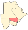
Moshaweng is a village in Kweneng District of Botswana. It is located 60 km west of Molepolole. The population of Moshaweng was 974 in 2001 census.[1]
It was the ancient name of Gaborone.
References
- ^ "Distribution of population by sex by villages and their associated localities: 2001 population and housing census". Archived from the original on 24 November 2007. Retrieved 9 February 2008.
- v
- t
- e
 Kweneng District of the Republic of Botswana
- Gabane
- Kopong
- Letlhakeng
- Mogoditshane
- Molepolole
- Thamaga
- Boatlaname
- Botlhapatlou
- Ditshegwane
- Ditshukudu
- Dutlwe
- Gakgatla
- Hatsalatladi
- Kaudwane
- Kgope
- Khudumelapye
- Kotolaname
- Kubung
- Kumakwane
- Kweneng
- Lentsweletau
- Lephephe
- Losilakgokong
- Maboane
- Mahetlwe
- Malwelwe
- Mantshwabisi
- Metsimotlhabe
- Mmankgodi
- Mmanoko
- Mmopane
- Mogonono
- Monwane
- Moshaweng
- Motokwe
- Ngware
- Salajwe
- Sesung
- Shadishadi
- Sojwe
- Sorilatholo
- Takatokwane
- Tsetseng
- Tswaane
24°27′5″S 25°2′1″E / 24.45139°S 25.03361°E / -24.45139; 25.03361
 | This Botswana location article is a stub. You can help Wikipedia by expanding it. |
- v
- t
- e


