Libbey, Oklahoma
Unincorporated community in Oklahoma, United States
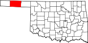
Libbey or Libby Siding is a settlement in northwest Texas County, Oklahoma,[1] situated in the Oklahoma Panhandle, at an elevation of 3,724 feet.[1] It is located approximately six miles southwest of Elkhart, Kansas on US Route 56.[2] It is on the Atchison, Topeka and Santa Fe Railroad.[3]
Libbey was the locale for Irish artist John Gerrard’s internationally-displayed exhibition, “Sow Farm (near Libbey, Oklahoma) 2009,” shot around an agricultural facility there.[4]
References
- ^ a b U.S. Geological Survey Geographic Names Information System: Libbey, Oklahoma
- ^ Oklahoma Atlas & Gazetteer, DeLorme, 1st ed., 1998, p.14 ISBN 0899332838
- ^ Elkhart South, OK, 7.5 Minute Topographic Quadrangle, USGS, 1973
- ^ "Sow Farm (near Libbey, Oklahoma) 2009". JohnGerrand.net. Retrieved June 22, 2021.
- v
- t
- e
Municipalities and communities of Texas County, Oklahoma, United States
County seat: Guymon
- Guymon
- Hooker
- Goodwell
- Hardesty
- Optima
- Texhoma
- Tyrone
- Adams
- Baker
- Hough
communities
- Eva
- Four Corners
- Libbey
- Mouser
- Muncy
- Straight
- Oklahoma portal
- United States portal

36°56′14″N 101°58′30″W / 36.93722°N 101.97500°W / 36.93722; -101.97500
 | This Oklahoma state location article is a stub. You can help Wikipedia by expanding it. |
- v
- t
- e


