Laurel Springs, North Carolina
Unincorporated community in North Carolina, United States
36°24′41″N 81°15′46″W / 36.41139°N 81.26278°W / 36.41139; -81.2627828644
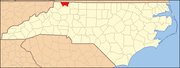
Laurel Springs is an unincorporated community in Alleghany County, North Carolina, United States. Laurel Springs is located at the junction of North Carolina Highway 18 and North Carolina Highway 88 near the Ashe County line, 10.2 miles (16.4 km) southwest of Sparta.[2] The Blue Ridge Parkway also crosses the center of the community. Laurel Springs has a post office with ZIP code 28644.[3][4]
The Robert L. Doughton House was listed on the National Register of Historic Places in 1979.[5]
References
- ^ "Laurel Springs". Geographic Names Information System. United States Geological Survey, United States Department of the Interior.
- ^ Alleghany County, North Carolina (Map). North Carolina Department of Transportation. 2009.
- ^ United States Postal Service (2012). "USPS - Look Up a ZIP Code". Retrieved February 15, 2012.
- ^ "Postmaster Finder - Post Offices by ZIP Code". United States Postal Service. Retrieved March 24, 2013.
- ^ "National Register Information System". National Register of Historic Places. National Park Service. July 9, 2010.
- v
- t
- e
Municipalities and communities of Alleghany County, North Carolina, United States
County seat: Sparta
communities
- Cherry Lane
- Ennice
- Glade Valley
- Laurel Springs
- Piney Creek
- Roaring Gap
- Scottville
- Twin Oaks
- North Carolina portal
- United States portal
This article about a location in Alleghany County, North Carolina is a stub. You can help Wikipedia by expanding it. |
- v
- t
- e


