Kematen an der Ybbs
Place in Lower Austria, Austria

Coat of arms
(2018-01-01)[2]
3330
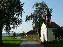
Kematen an der Ybbs is a town in the district of Amstetten in Lower Austria, Austria.
Geography
Kematen an der Ybbs lies in the Mostviertel in Lower Austria on the Ybbs River. About 22 percent of the municipality is forested.
References
Wikimedia Commons has media related to Kematen an der Ybbs.
- v
- t
- e
Municipalities in the district of Amstetten
- Allhartsberg
- Amstetten
- Ardagger
- Aschbach-Markt
- Behamberg
- Biberbach
- Ennsdorf
- Ernsthofen
- Ertl
- Euratsfeld
- Ferschnitz
- Haag
- Haidershofen
- Hollenstein an der Ybbs
- Kematen an der Ybbs
- Neuhofen an der Ybbs
- Neustadtl an der Donau
- Oed-Öhling
- Opponitz
- Seitenstetten
- Sonntagberg
- Sankt Georgen am Reith
- Sankt Georgen am Ybbsfelde
- Sankt Pantaleon-Erla
- Sankt Peter in der Au
- St. Valentin
- Strengberg
- Viehdorf
- Wallsee-Sindelburg
- Weistrach
- Winklarn
- Wolfsbach
- Ybbsitz
- Zeillern
Authority control databases | |
|---|---|
| International |
|
| National |
|
 | This Lower Austria location article is a stub. You can help Wikipedia by expanding it. |
- v
- t
- e


