Irará
City in Bahia State, Brazil
You can help expand this article with text translated from the corresponding article in Portuguese. Click [show] for important translation instructions.
- Machine translation, like DeepL or Google Translate, is a useful starting point for translations, but translators must revise errors as necessary and confirm that the translation is accurate, rather than simply copy-pasting machine-translated text into the English Wikipedia.
- Do not translate text that appears unreliable or low-quality. If possible, verify the text with references provided in the foreign-language article.
- You must provide copyright attribution in the edit summary accompanying your translation by providing an interlanguage link to the source of your translation. A model attribution edit summary is
Content in this edit is translated from the existing Portuguese Wikipedia article at [[:pt:Irará]]; see its history for attribution. - You may also add the template
{{Translated|pt|Irará}}to the talk page. - For more guidance, see Wikipedia:Translation.
Municipality in Northeast, Brazil

Seal
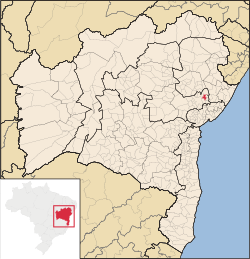
Location in Bahia
 Brazil
 (2020)[2]
44255-000
Irará is a city in Bahia, Brazil. The municipality is the hometown of former professional footballer Dida, of A.C. Milan and Brazil national football team fame and musician Tom Zé.
Until the 17th century, the region was inhabited by the
Irará was settled by the Paiaiá, a subgroup of the Quiriris peoples. The land was annexed by the Portuguese in the 16th century, and became part of the vast land holdings of Garcia d'Ávila (1528-1609) in the Captaincy of Bahia. The Jesuits explored the area from the north via their settlement in present-day Água Fria. Bandeirantes entered the city to both hunt for precious stones in the Serra de Irará and to enslave indigenous people. Two structures remain from the bandeirantes, a church in the Vila de Bento Simões and a chapel in Caroba.
In mid-1717, the first explorations of the lands in the center of the current municipality were registered, where
Antônio Homem da Fonseca Correia was an early permanent Portuguese settler to the area. He built a chapel dedicated to Our Lady of the Conception in 1717, and left the land to his son. The farmhouse of the family gave rise to the village of Irará, which was also a site of a Paiaiá settlement.
References
- ^ a b "Área dos municípios" [Area of the municipalities] (in Portuguese). Brazilian Institute of Geography and Statistics(IBGE). Retrieved 2018-04-13.
- ^ IBGE 2020
- v
- t
- e

Capital: Salvador
Mesoregion Centro Norte Baiano | |||||||||||
|---|---|---|---|---|---|---|---|---|---|---|---|
| |||||||||||

Mesoregion Centro Sul Baiano | |||||||||||||||||
|---|---|---|---|---|---|---|---|---|---|---|---|---|---|---|---|---|---|
| |||||||||||||||||
Mesoregion Extremo Oeste Baiano | |||||||
|---|---|---|---|---|---|---|---|
| |||||||
Mesoregion Metropolitana de Salvador | |||||||
|---|---|---|---|---|---|---|---|
| |||||||
Mesoregion Nordeste Baiano | |||||||||||||
|---|---|---|---|---|---|---|---|---|---|---|---|---|---|
| |||||||||||||
Mesoregion Sul Baiano | |
|---|---|
Mesoregion Vale São-Franciscano da Bahia | |||||||||
|---|---|---|---|---|---|---|---|---|---|
| |||||||||
| Authority control databases: Geographic |
|
|---|
 | This Bahia, Brazil location article is a stub. You can help Wikipedia by expanding it. |
- v
- t
- e


