Herzele
Municipality in Flemish Community, Belgium

Flag

Coat of arms
Location of Herzele


Herzele
Location in Belgium 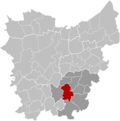
Location of Herzele in East Flanders

 Belgium
 (2018-01-01)[1]
9550-9552
41027
Herzele (Dutch pronunciation: [ˈɦɛrzeːlə]) is a municipality located in the Belgian province of East Flanders in the Denderstreek. The municipality comprises the villages of Borsbeke [nl], Herzele proper, Hillegem [nl], Ressegem [nl], Sint-Antelinks [nl], Sint-Lievens-Esse [nl], Steenhuize-Wijnhuize [nl] and Woubrechtegem [nl]. In 2021, Herzele had a total population of 18,414. The total area is 47.40 km2.[2] The current mayor of Herzele is Johan Van Tittelboom, from the Open Flemish Liberals and Democrats party.
Herzele is crossed by two brooks, the Molenbeek in Borsbeke, Herzele, Ressegem, and Hillegem, as well as the Molenbeek-Ter Erpenbeek in Herzele, Sint-Lievens-Esse, Woubrechtegem, and Ressegem.

References
External links
 Media related to Herzele at Wikimedia Commons
- Official website (in Dutch)
Places adjacent to Herzele | |
|---|---|


- v
- t
- e

- Bold indicates cities
- Italic indicates municipality with language facilities
Authority control databases | |
|---|---|
| International |
|
| National |
|
| Geographic |
|
| Other |
|
 | This East Flanders location article is a stub. You can help Wikipedia by expanding it. |
- v
- t
- e


