Fort Portal–Kasese–Mpondwe Road
Ugandan road in the Western Region
Major junctions
Hima
Kasese
Kikorongo
The Fort Portal–Kasese–Mpondwe Road also Fort Portal–Mpondwe Road, is a road in the Western Region of Uganda, connecting the towns of Fort Portal, Hima, Kasese, Kikorongo and the border town of Mpondwe.
Location
The road starts at Fort Portal, the headquarters of Kabarole District. It travels southwestwards through Rwimi, Hima, Kasese and Kikorongo. At Kiorongo, the road makes a 90 degree turn westwards to end at Mpondwe, at the international border with the Democratic Republic of the Congo, a total distance of about 135 kilometres (84 mi).[1] The coordinates of the road at Kikorongo are:0°00'00.0"N, 29°59'55.0"E (Latitude:0.000003; 29.998607).[2]
Upgrade to bituminous surface
This road was improved to class II bituminous surface before 2013.[3]
Points of interest
The following lie along or near this road
1. Virika Hospital, located in Fort Portal's central business district.[4]
2. The town of Rwimi, about 45 kilometres (28 mi), south of Fort Portal.[5]
3. Hima, lies about 56 kilometres (35 mi) south of Fort Portal.[6]
4. Kasese Airport, in the middle the town of Kasese, about 77 kilometres (48 mi) south of Fort Portal.[7]
5. Kasese Cobalt Company Limited lies in Kasese, south of the central business district.
6. At Kikorongo, the road takes a 90 degrees turn to the right and heads westwards towards the border with the Democratic Republic of the Congo. Kikorongo is a town in Kasese District, about 22 kilometres (14 mi), south of Kasese.[8]
7. At Katojo Village a road branches off this road and proceeds south to Katwe Village and Mweya Safari Lodge, inside Queen Elizabeth National Park.[9]
See also
References
- ^ Google (23 October 2022). "Road Distance Between Fort Portal, Western Region, Uganda And Customs Mpondwe, Bwera, Kasese District, Western Region, Uganda" (Map). Google Maps. Google. Retrieved 23 October 2022.
- ^ Google (23 October 2022). "Location of Fort Portal–Kasese–Mpondwe Road" (Map). Google Maps. Google. Retrieved 23 October 2022.
- ^ Rwanyekiro, Isaiah (12 February 2013). "Uganda's Road Network has improved significantly". New Vision. Kampala. Retrieved 20 May 2016.
- ^ Google. "Location of Virika Hospital, Fort Portal, Uganda" (Map). Google Maps. Google.
- ^ Google (23 October 2022). "Road Distance Between Fort Portal, Western Region, Uganda And Rwimi, Western Region, Uganda" (Map). Google Maps. Google. Retrieved 23 October 2022.
- ^ Google (23 October 2022). "Road Distance Between Fort Portal, Uganda And Hima, Uganda" (Map). Google Maps. Google. Retrieved 23 October 2022.
- ^ Google (23 October 2022). "Road Distance Between Fort Portal, Uganda And Kasese, Uganda" (Map). Google Maps. Google. Retrieved 23 October 2022.
- ^ Google (23 October 2022). "Road Distance Between Kasese, Uganda And Kikorongo Junction, Uganda" (Map). Google Maps. Google. Retrieved 23 October 2022.
- ^ Google (23 October 2022). "Location of Katojo Village Where Road to Katwe Village And Mweya Safari Lodge Branches off Fort Portal–Kasese–Mpondwe Road" (Map). Google Maps. Google. Retrieved 23 October 2022.
External links
- Webpage of Uganda National Road Authority
- Photograph of Fort Portal–Kasese–Mpondwe Road At Flickr.com
- v
- t
- e

Capital: Kabarole
sub-counties
- Burahya County

villages
- Fort Portal
- Kabarole
- Karago
- Kasusu
- Kijura
- Itojo
- Kichwamba
- Nyakasura
landmarks
- Aziz Azion
- Crescent Baguma
- Ronnie Balya
- Patrick Bitature
- Robina Bwita
- William Byaruhanga
- Stephen Isabalija
- Clovis Kalyebara
- Juliana Kanyomozi
- Nobel Mayombo
- Kayanja Muhanga
- Andrew Mwenda
- Barbara Ntambirweki
- John Ntambirweki
- Christine Nyangoma
- Doreen Nyanjura
- Rukidi IV of Toro
- Olimi III of Toro
- Alex Ruhunda
- Rukidi III of Toro
- Asaba Edson Ruyonga
| ||
|---|---|---|
Capital: Kasese | ||
| Towns and villages | 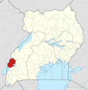 | |
| Economy |
| |
| Transport |
| |
| Energy |
| |
| Notable landmarks |
| |
| Health | ||
| Notable people | ||
00°00′00″N 29°59′55″E / 0.00000°N 29.99861°E / 0.00000; 29.99861


