Felixton
Place in KwaZulu-Natal, South Africa
28°49′52″S 31°53′38″E / 28.831°S 31.894°E / -28.831; 31.894 (2011)[1]
3875
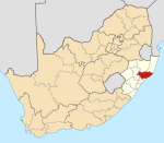
Felixton is a town in King Cetshwayo District Municipality in the KwaZulu-Natal province of South Africa.
Village 10 km south-east of Empangeni, first settled in 1907. Said to have been named either after Viscount Herbert John Gladstone, nicknamed Felix, or after a local pioneer, Felix Piccione.[2] The local sugar mill is one of the largest in country.
Sources
- Erasmus, B.P.J.: Op Pad in Suid-Afrika. 1995. ISBN 1-86842-026-4
- Rosenthal, Eric: 'Ensiklopedie van Suidelike Afrika. 1967
References
- ^ a b c d "Sub Place Felixton". Census 2011.
- ^ "Dictionary of Southern African Place Names (Public Domain)". Human Science Research Council. p. 162.
- v
- t
- e
Municipalities and communities of King Cetshwayo District Municipality, KwaZulu-Natal
District seat: Richards Bay
- eMpangeni
- eSikhawini
- Felixton
- Richards Bay
 | This KwaZulu-Natal location article is a stub. You can help Wikipedia by expanding it. |
- v
- t
- e


