Dearing, Georgia
Town in Georgia, United States
33°24′48″N 82°23′5″W / 33.41333°N 82.38472°W / 33.41333; -82.38472 (2020)[2]
30808
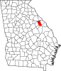
Dearing is a town in McDuffie County, Georgia, United States. The population was 529 at the 2020 census.[2] It is part of the Augusta metropolitan area.
History
An early variant name was "Lombardy".[5] A post office called Lombardy was established in 1823, and the name was changed to Dearing in 1893.[6] The Georgia General Assembly incorporated the place in 1910 as the "Town of Dearing".[7] The present name is after William Dearing, a railroad official.[8]
Geography
Dearing is located in southeastern McDuffie County at 33°24′48″N 82°23′5″W / 33.41333°N 82.38472°W / 33.41333; -82.38472 (33.413425, -82.384781).[9] U.S. Routes 78 and 278 run together through the town, leading northwest 8 miles (13 km) to Thomson, the county seat, and east 4 miles (6 km) to Harlem. Augusta is 24 miles (39 km) east of Dearing.
According to the United States Census Bureau, the town has a total area of 0.8 square miles (2.1 km2), of which 0.01 square miles (0.03 km2), or 1.09%, are water.[1] The town is drained to the south by tributaries of Headstall Creek, which flows south to Brier Creek, a tributary of the Savannah River.
Demographics
| Census | Pop. | Note | %± |
|---|---|---|---|
| 1920 | 256 | — | |
| 1930 | 246 | −3.9% | |
| 1940 | 273 | 11.0% | |
| 1950 | 325 | 19.0% | |
| 1960 | 403 | 24.0% | |
| 1970 | 555 | 37.7% | |
| 1980 | 539 | −2.9% | |
| 1990 | 547 | 1.5% | |
| 2000 | 441 | −19.4% | |
| 2010 | 549 | 24.5% | |
| 2020 | 529 | −3.6% | |
| U.S. Decennial Census[10] | |||
As of the census[3] of 2000, there were 441 people, 178 households, and 126 families residing in the town. By 2020, its population was 529.
See also
 State of Georgia portal

References
- ^ a b "2022 U.S. Gazetteer Files: Georgia". United States Census Bureau. Retrieved January 23, 2023.
- ^ a b "P1. Race – Dearing town, Georgia: 2020 DEC Redistricting Data (PL 94-171)". U.S. Census Bureau. Retrieved January 23, 2023.
- ^ a b "U.S. Census website". United States Census Bureau. Retrieved January 31, 2008.
- ^ "US Board on Geographic Names". United States Geological Survey. October 25, 2007. Retrieved January 31, 2008.
- ^ Krakow, Kenneth K. (1975). Georgia Place-Names: Their History and Origins (PDF). Macon, GA: Winship Press. p. 60. ISBN 0-915430-00-2.
- ^ "Post Offices". Jim Forte Postal History. Retrieved April 17, 2018.
- ^ Acts and Resolutions of the General Assembly of the State of Georgia. State printer. 1910. p. 583.
- ^ "McDuffie County". New Georgia Encyclopedia. Retrieved April 18, 2018.
- ^ "US Gazetteer files: 2010, 2000, and 1990". United States Census Bureau. February 12, 2011. Retrieved April 23, 2011.
- ^ "Census of Population and Housing". Census.gov. Retrieved June 4, 2015.
- v
- t
- e
Municipalities and communities of McDuffie County, Georgia, United States
County seat: Thomson
- Dearing
communities
- Georgia portal
- United States portal
Authority control databases | |
|---|---|
| International |
|
| National |
|
| Geographic |
|


