Cintalapa
Municipality in Chiapas, Mexico
Cintalapa Cintalapa | |
|---|---|
Municipality | |
 Coat of arms | |
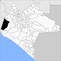 Location of Cintalapa in Chiapas | |
| 16°41′16″N 93°42′39″W / 16.68778°N 93.71083°W / 16.68778; -93.71083 | |
| Country |  Mexico Mexico |
| State | Chiapas |
| Area | |
| • Total | 928.4 sq mi (2,404.6 km2) |
| Population (2020) | |
| • Total | 88,106 |
| • Density | 95/sq mi (37/km2) |
Cintalapa is a town and municipality in the Mexican state of Chiapas in southern Mexico. It covers an area of 2404.6 km².
As of 2020, the municipality had a total population of 88,106,[1][2] up from 64,013 as of 2005.[3]
The municipality had 943 localities, the largest of which (with 2010 populations in parentheses) were: Cintalapa de Figueroa (42,467), Lázaro Cárdenas (3,002), classified as urban, and Cereso 14 (El Amate) (2,243), Villamorelos (1,677), Nueva Tenochtitlán (Rizo de Oro) (1,640), Emiliano Zapata (1,507), Pomposo Castellanos (1,489), Francisco I. Madero (1,444), Mérida (1,412), and Vista Hermosa (1,149), classified as rural.[2]
References
- ^ "Cintalapa (Municipality, Mexico) - Population Statistics, Charts, Map and Location". www.citypopulation.de. Retrieved 2024-02-21.
- ^ a b "Cintalapa". Catálogo de Localidades. Secretaría de Desarrollo Social (SEDESOL). Archived from the original on 5 March 2016. Retrieved 23 April 2014.
- ^ "Cintalapa". Enciclopedia de los Municipios de México. Instituto Nacional para el Federalismo y el Desarrollo Municipal Gobierno del Estado de Chiapas. Archived from the original on June 17, 2011. Retrieved July 25, 2008.
- v
- t
- e
 State of Chiapas
Tuxtla Gutiérrez (capital)
- Anthem
- Art
- Cuisine
- Government
- Congress
- Governors

- Chiapas Depression
- Chiapas Highlands
- Lacandon Forest
- Sierra Madre de Chiapas
- Soconusco
- Acacoyagua
- Acala
- Acapetahua
- Aldama
- Altamirano
- Amatán
- Amatenango de la Frontera
- Amatenango del Valle
- Ángel Albino Corzo
- Arriaga
- Bejucal de Ocampo
- Bella Vista
- Benemérito de las Américas
- Berriozábal
- Bochil
- El Bosque
- Cacahoatán
- Capitán Luis Ángel Vidal
- Catazajá
- Chalchihuitán
- Chamula
- Chanal
- Chapultenango
- Chenalhó
- Chiapa de Corzo
- Chiapilla
- Chicoasén
- Chicomuselo
- Chilón
- Cintalapa
- Coapilla
- Comitán
- La Concordia
- Copainalá
- Emiliano Zapata
- Escuintla
- Francisco León
- Frontera Comalapa
- Frontera Hidalgo
- La Grandeza
- Honduras de la Sierra
- Huehuetán
- Huixtán
- Huitiupán
- Huixtla
- La Independencia
- Ixhuatán
- Ixtacomitán
- Ixtapa
- Ixtapangajoya
- Jiquipilas
- Jitotol
- Juárez
- Larráinzar
- La Libertad
- Mapastepec
- Maravilla Tenejapa
- Las Margaritas
- Marqués de Comillas
- Mazapa de Madero
- Mazatán
- Metapa
- Mezcalapa
- Mitontic
- Montecristo de Guerrero
- Motozintla
- Nicolás Ruiz
- Ocosingo
- Ocotepec
- Ocozocoautla de Espinosa
- Ostuacán
- Osumacinta
- Oxchuc
- Palenque (Palenque)
- Pantelhó
- Pantepec
- El Parral
- Pichucalco
- Pijijiapan
- El Porvenir
- Pueblo Nuevo Solistahuacán
- Rayón
- Reforma
- Rincón Chamula San Pedro
- Las Rosas
- Sabanilla
- Salto de Agua
- San Andrés Duraznal
- San Cristóbal de las Casas
- San Fernando
- San Juan Cancuc
- San Lucas
- Santiago el Pinar
- Siltepec
- Simojovel
- Sitalá
- Socoltenango
- Solosuchiapa
- Soyaló
- Suchiapa
- Suchiate
- Sunuapa
- Tapachula
- Tapalapa
- Tapilula
- Tecpatán
- Tenejapa
- Teopisca
- Tila
- Tonalá
- Totolapa
- La Trinitaria
- Tumbalá
- Tuxtla Chico
- Tuxtla Gutiérrez
- Tuzantán
- Tzimol
- Unión Juárez
- Venustiano Carranza
- Villa Comaltitlán
- Villa Corzo
- Villaflores
- Yajalón
- Zinacantán


