Carrick, County Donegal
Village in County Donegal, Ireland
Village in Ulster, Ireland
Carrick An Charraig | |
|---|---|
Village | |
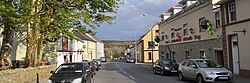 Carrick's main street | |
| 54°39′28″N 8°38′00″W / 54.6578°N 8.6333°W / 54.6578; -8.6333 | |
| Country | Ireland |
| Province | Ulster |
| County | County Donegal |
| Government | |
| • Dáil Éireann | Donegal |
| • EU Parliament | Midlands–North-West |
| Population (2016)[1] | 265 |
| Irish Grid Reference | G591790 |
Carrick (Irish: An Charraig, meaning 'the rock')[2] is a village located within the civil parish of Glencolmcille in County Donegal, Ireland. As of the 2016 census, the population of the village was 265.[1] Carrick is located between neighbouring towns Glencolmcille, Meenanary, Teelin and Kilcar. Nearby is Sliabh Liag, the highest sea cliff in Europe.
Amenities
The village has a post office as well as a number of pubs, shops and coffee shops.[citation needed] The Roman Catholic church in the village is dedicated to Saint Colm Cille, and was built in the 1850s.[3] The local national school has an enrollment of approximately 80 pupils,[4] and the secondary school had an enrollment of 214 students in 2019.[5] Teams representing the secondary school, Coláiste na Carraige, have won a number of trophies in Gaelic football.[citation needed]
References
- ^ a b "Sapmap Area - Settlements - An Charraig". Census 2016. Central Statistics Office. April 2016. Retrieved 21 October 2020.
- ^ "An Charraig / Carrick". logainm.ie. Irish Placenames Commission. Retrieved 21 October 2020.
- ^ "Eaglais Chaitliceach Naomh Colm Cille, An Charraig, County Donegal". buildingsofireland.ie. National Inventory of Architectural Heritage. Retrieved 21 October 2020.
- ^ "Scoil Naisiúnta Na Carraige (18611F)". education.ie. Department of Education. Retrieved 21 October 2020.
- ^ "Subject Inspection Report - Coláiste Na Carraige, Carrick, Co. Donegal" (PDF). education.ie. Department of Education. 21 October 2019. Retrieved 21 October 2020.
- v
- t
- e
Places in County Donegal

- Annagry
- Ardara
- Ballindrait
- Ballintra
- Ballyliffin
- Bridgend
- Bruckless
- Burnfoot
- Burtonport
- Carrick
- Carrigans
- Carrigart
- Churchill
- Cloghan
- Clonmany
- Convoy
- Cranford
- Creeslough
- Crolly
- Culdaff
- Doochary
- Downings
- Drumkeen
- Dunfanaghy
- Dunkineely
- Dunlewey
- Fahan
- Fintown
- Frosses
- Glen
- Glencolmcille
- Greencastle
- Inver
- Kerrykeel
- Kilcar
- Killea
- Killygordon
- Kilmacrennan
- Laghy
- Leabgarrow
- Lettermacaward
- Loughanure
- Malin
- Malin Beg
- Manorcunningham
- Meenlaragh
- Milford
- Mountcharles
- Moville
- Muff
- Narin
- Newtowncunningham
- Pettigo
- Porthall
- Portnablagh
- Quigley's Point
- Raphoe
- Rathmullan
- Redcastle
- Rossnowlagh
- Shrove
- St Johnston
- Teelin
- Termon
- List of townlands in County Donegal
- Category:Mountains and hills of County Donegal
- Category:Rivers of County Donegal
- Category:Geography of County Donegal
 | This article related to the geography of County Donegal, Ireland is a stub. You can help Wikipedia by expanding it. |
- v
- t
- e


