Bedell Covered Bridge
Bridge in Vermont and Haverhill, New Hampshire
44°02′43″N 72°04′27″W / 44.04528°N 72.07417°W / 44.04528; -72.07417 (Bedell Bridge) Bedell Covered Bridge


The Bedell Bridge was a Burr truss covered bridge that spanned the Connecticut River between Newbury, Vermont and Haverhill, New Hampshire. Until its most recent destruction in 1979, it was, with a total length of 382 feet (116 m), the second-longest covered bridge in the United States.[a] The bridge was divided into two spans of roughly equal length, and rested on a central pier and shore abutments constructed from mortared rough stone. The eastern abutment has been shored up by the addition of a concrete footing. The bridge was 23 feet (7.0 m) wide, with a roadway width of 18.5 feet (5.6 m). Because the state line is the western low-water mark of the Connecticut River, most of the bridge was in New Hampshire; only the western abutment is in Vermont.[3]
The site is now part of the 74-acre (30 ha) Bedell Bridge State Park in Haverhill, New Hampshire.
History
There have been five bridges on this site. The first was built in 1805 and heavily damaged in 1823. Quickly rebuilt that year, it was washed away in 1841. A third bridge was carried away by a spring flood in 1862. The fourth bridge was destroyed in a storm on July 4, 1866, and replaced the same year. This fifth bridge was in service for 92 years, until it was closed to traffic in 1958.[3] It was scheduled for demolition in 1973 due to heavy damage that year.
A "Save the Bedell Bridge Committee" raised $250,000 to rebuild the bridge, which was completed by 1978, and included the establishment of the associated Bedell Bridge State Park in the area of the eastern abutment. The bridge was rededicated on July 22, 1979, only to be blown away again by a windstorm on September 14, 1979.[citation needed] The state park, as well as the abutments and a pier in the river, are all that remain.
When first built, the bridge was in private ownership, and a toll was charged to cross it. In 1916, the towns of Newbury and Haverhill purchased the bridge and eliminated the toll. Ownership of the bridge was transferred to the state of New Hampshire in 1967.[3]
Image gallery
-
 Site of the bridge, with a pier standing alone in the river
 -
 The pier complete with crowning tree.
 -
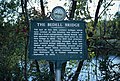 New Hampshire Historical Marker No. 136
 -
 The memorial marker
 -
 People on the eastern abutment, giving a sense of scale


See also
 New Hampshire portal

- List of crossings of the Connecticut River
- List of New Hampshire covered bridges
- List of Vermont covered bridges
- National Register of Historic Places listings in Grafton County, New Hampshire
- National Register of Historic Places listings in Orange County, Vermont
- List of bridges on the National Register of Historic Places in New Hampshire
- List of bridges on the National Register of Historic Places in Vermont
Notes
References
- ^ "National Register Information System". National Register of Historic Places. National Park Service. July 9, 2010.
- ^ "Wells River and Woodsville site". Archived from the original on 2007-08-21. Retrieved 2007-09-03.
- ^ a b c "NRHP nomination for Bedell Covered Bridge". National Park Service. 1975. Retrieved 2014-03-18.
- Delany, Edmund Thomas (1983). The Connecticut River: New England's Historic Waterway. The Globe Pequot Press. p. 131. ISBN 978-0-87106-980-1.
External links
Wikimedia Commons has media related to Bedell Covered Bridge.
- Bedell Bridge State Park official site
- Haverhill, New Hampshire Bedell Bridge site
- Wildernet site
Crossings of the Connecticut River | ||||
|---|---|---|---|---|
| ||||


- v
- t
- e
Landmark
- The Epic of American Civilization Murals
- Ashland Gristmill and Dam
- Canaan Street Historic District
- Central Square Historic District
- Colburn Park Historic District
- Dorchester Common Historic District
- Enfield Shaker Historic District
- Enfield Village Historic District
- Haverhill Corner Historic District
- Hebron Village Historic District
- Lyme Center Historic District
- Lyme Common Historic District
- Orford Street Historic District
- Plymouth Historic District
- Shepard Hill Historic District
- True Farm
- Webster Estate
- Abbie Greenleaf Library
- Ashland Junior High School
- Ashland Railroad Station
- Bath Covered Bridge
- Bedell Covered Bridge‡
- Boulderwood
- Brick Store
- Bristol Town Hall
- Burleigh Brae and Webster Boathouse
- Burt–Cheney Farm
- Camp Carnes
- Camp Mowglis
- Camp Ossipee
- Canaan Meetinghouse
- Centre Village Meeting House
- Chapel of the Holy Cross
- Chocorua Island Chapel
- Daniel Carr House
- Dorchester Community Church
- Dow Academy
- Edward H. Lane House
- Enfield Center Town House
- Felsengarten
- First Free Will Baptist Church and Vestry
- Frost Place
- Goodall-Woods Law Office
- Great Hollow Road Stone Arch Bridge
- Hanover Town Library
- Haverhill–Bath Covered Bridge
- Hewitt House
- Holderness Free Library
- Holderness Inn
- Jeremiah Hutchins Tavern
- Lisbon Inn
- Littleton Town Building
- Lovett's by Lafayette Brook
- Lyme–East Thetford Bridge‡
- Minot–Sleeper Library
- Morey Memorial Bridge‡
- Moses Kent House
- Norman and Marion Perry House
- North Holderness Freewill Baptist Church–Holderness Historical Society Building
- Old Grafton County Courthouse
- Owls Head
- Piermont Bridge‡
- The Rocks
- Rockywold–Deephaven Camps
- Sawyer–Medlicott House
- Sphinx Tomb
- Spring Hill Farm
- St. Mark's Episcopal Church
- Stone Arch Underpass
- Swiftwater Covered Bridge
- Thayer's Hotel
- Trinity Church
- US Post Office and Courthouse–Littleton Main
- Watch Rock Camp
- Whipple House
- Woodsville Opera Building
‡This historic property also has portions in an adjacent state.


