Banikoara
Place in Alibori Department, Benin
11°18′N 2°26′E / 11.300°N 2.433°E / 11.300; 2.433 Benin
Benin (2013)
BP: 01
Banikoara is a town, arrondissement and commune located in the Alibori Department of Benin. It lies 69 kilometers west of Kandi at the heart of the most productive cotton-growing region in Benin. Its name is a Europeanized version of a Bariba phrase meaning "Bani's town", and honors its founder, Bani Gansé.
Banikoara, like many areas of Benin, is home to a constituent monarchy.[1]
Administrative divisions
Banikoara is subdivided into 10 arrondissements; Banikoara, Founougo, Gomparou, Goumori, Kokey, Kokiborou, Ounet, Sompérékou, Soroko and Toura. They contain 53 villages and 11 urban districts.[2]
The arrondissement of Banikoara contains the villages of Arbonga, Demanou, Derou Garou, Kokire, Kommon, Kori Ginguiri, Tokey Banta, Wagou, Weterou and Yadikparou.[3]
Demographics
The commune covers an area of 4383 square kilometres and as of 2002 had a population of 152,028 people.[2][4] In 2008 there was an estimated 24,917 living in the main town.[5]
Economy
Most of the population are engaged in agricultural activities followed by trade and handicrafts. 51 024,00 hectares of land are devoted to agriculture, accounting for 7.32% of the total land area.[2] The main crops grown are maize, cotton, sorghum and cowpeas.[2]
Electricity used in Banikora often has to be produced by a generator due to a defective solar system and unreliable mains electricity.[6] The telephone lines are in poor condition, which makes it difficult to maintain a regular and reliable connection for Internet access.[6] Banikoara is 60 kilometres from the nearest hard road and its development is hampered by its isolation until infrastructure develops.[6]
Media
UNESCO has donated four computers and other equipment and provided an initial two-week training and been responsible for the establishment of a radio station in Banikoara in 1994.[6] They had provided education to local people in basic IT and Internet skills since February 2002, text processing, photocopying, scanning, printing and photography.[6]
References
- ^ "Présidence du Haut conseil des rois du Bénin:Kpodégbé Lanmanfan reconduit pour un nouveau mandat | Benin : Actualité, politique, Sport, Santé, Artetculture". Archived from the original on 2022-01-04.
- ^ a b c d "Banikoara". Atlas Monographique des Communes du Benin. Retrieved January 5, 2010.
- ^ "Point des Realisations par Village" (PDF). Direction Générale de l'Eau du Benin. 24 April 2014. Archived from the original (PDF) on 4 March 2016. Retrieved 28 July 2015.
- ^ "Communes of Benin". Statoids. Archived from the original on 2 January 2010. Retrieved January 5, 2010.
- ^ "Banikoara". World Gazetteer. Archived from the original on February 9, 2013. Retrieved 2008-12-21.
- ^ a b c d e "Benin-Banikoara". UNESCO. Retrieved January 8, 2010.

| ||
|---|---|---|
| Banikoara | 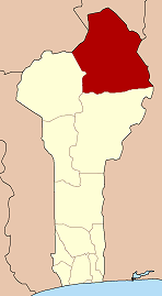 | |
| Gogounou | ||
| Kandi | ||
| Karimama | ||
| Malanville | ||
| Ségbana | ||
 | This Alibori Department location article is a stub. You can help Wikipedia by expanding it. |
- v
- t
- e


